First Iron Age sites can be found in Africa
south of the Equator.
Early in the first millennium AD perhaps, the Khoe begin to arrive in south-western
Africa. They are the antecedents of the present Nama. The Khoe are nomadic pastoralists
and they introduce the first of the cultural revolutions that transforms the relative
equanimity of southern Africa’s stone age. Early settlements along the Atlantic
coast, especially at the Kuiseb and Uniab mouths and the Namib Desert are witness of the
rise of the pastoral economy of the Central Namib Desert. Numerous settlements can be
found at Namibia’s highest mountain, the Brandberg (2 646 m)(meaning "Burnt or
Fire Mountain" – "Brandberg" in German, "Dâunas" or
"Dâureb" in the Khoekhoegowab language (Nama/Dama), " Omukuruwaro" in
Otjiherero) and between the Ugab and Huab rivers (settlement of Gai-As which probably came
into existence only after 1500 A.D.). Archaeological research reveals that the Hunter-
Gatherer communities existed even at the period when the rock art tradition began to
disappear giving way to pastoral nomadism in many parts of Namibia. The first contact with
Europeans in the 15th Century leads to the collapse of nomadic pastoralism (D Period
between A.D. and 1 000 A.D.).
The "Große Spitzkoppe" from the North
Copyright of Photo: Dr. Klaus Dierks

Rockpainting in the "Große Spitzkoppe" Massif
(ca. 4400 - 100 B.C.)
Copyright of Photo: Dr. Klaus Dierks
 
The "Bushmen Paradise" in the Spitzkoppe Massif:
Erongo Region
Copyright of Photos: Dr. Klaus Dierks
Cave in the "Bushmen Paradise" in the Spitzkoppe
Massif
Copyright of Photos: Dr. Klaus Dierks
Rockpainting in the Cave in the "Bushmen Paradise" (ca. 4400 - 100 B.C.)
Copyright of Photos: Dr. Klaus Dierks

Scene in the Spitzkoppe Massif: Erongo Region
Copyright of Photo: Dr. Klaus Dierks

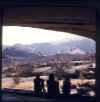
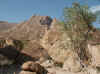
The Brandberg with the Königsstein is Namibia's highest
Mountain:
2 646 m: View from the East into the Tsisab Valley: The Mountain is composed of a single
mass of granite created 120 Million Years ago, a Time of tremendous geological Upheaval in
the Earth's History, when the old Gondwana Continent broke apart, separating Africa from
South-America: Erongo Region: April 1971
Copyright of Photo: Dr. Klaus Dierks

The Brandberg from the East into the Tsisab Gorge: with District
Road 2359: Erongo Region, March 2003
Copyright of Photo: Dr. Klaus Dierks

The Tsisab Gorge in the Brandberg: Erongo Region: View to South
West: There are so far approximately 1 000 painted Shelters with 45 000 individual
Paintings in the Brandberg Massif identified
Copyright of Photo: Dr. Klaus Dierks
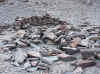
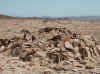
Prehistoric Stone Circle Architecture of Nomadic Pastoralists in
the Tsisab Gorge in the Brandberg (Around 1500 A.D.): View to the North-East: Erongo
Region, March 2003
Copyright of Photos: Dr. Klaus Dierks

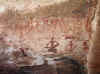
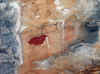
Rockpaintings in the Tsisab Gorge in the
Brandberg (ca. 4400 - 100 B.C.): The famous "White Lady" Rockpainting in Maack's
Shelter: Recent Research shows that the Figures are of pure Namibian Origin, April 1971
Copyright of Photo: Dr. Klaus Dierks
  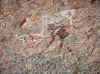
The Rock Paintings in Maack's Shelter with
"White Lady" in March 2003: A Number of the Figures, including the "White
Lady", display both white and red Body Paint and are highly decorated: There is a
lavish Use of Bead Strings and Bands to decorate the Knees, Ankles, Arms, Neck and Hair of
the Figures: Since the older Layers of Paintings and the simpler monochrome Figures could
perhaps be called "Bushman-Style", it is possible that the San (Bushmen) were in
the area in the distant Past: The more complex Figures appear to have been painted later,
since they mostly overlie the "Bushman Style" Paintings: We can assume that the
Age of these Paintings is at least 2000 Years old and many are much older

Ascent from Maack's Shelter to the Giraffe Cave
in the Brandberg, Tsisab Gorge: View to the South West, March 2003
Copyright of Photo: Dr. Klaus Dierks

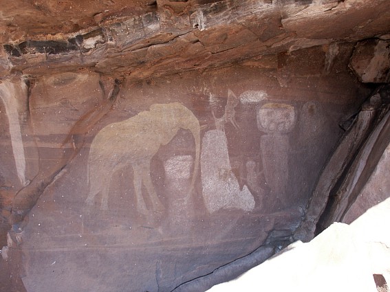
Rockpaintings in the Tsisab Gorge in the
Brandberg (ca. 4400 - 100 B.C.): The Giraffe Cave: The Paintings are, usually realistic
Portrayals, although they are often drawn with a twisted Perspective: The human Figures
have the Trunk, Legs and Head painted in Profile while the Shoulders and Arms are depicted
from a Frontal Perspective, March 2003
Copyright of Photo: Dr. Klaus Dierks
Ascent from the Giraffe Cave to the Ostrich Cave
in the Brandberg, Tsisab Gorge: View to the North East, March 2003
Copyright of Photo: Dr. Klaus Dierks

Rockpaintings in the Tsisab Gorge in the
Brandberg (ca. 4400 - 100 B.C.): The Ostrich Cave in March 2003: Many of the Paintings
display Brush Marks, therefore we can assume that the Tools used were probably Animal Hair
Brushes: The Colours used were Earth Colours, Red Hematite, Yellow Ochre, Charcoal, Black
Manganese and Calcium Carbonate
Copyright of Photo: Dr. Klaus Dierks
Ascent from the Ostrich Cave in the Brandberg to
Jochmann's Shelter, Tsisab Gorge: View to the South to the Tsisab-Spitze 2228 m, March
2003
Copyright of Photo: Dr. Klaus Dierks

View from Jochmann's Shelter, Tsisab Gorge: View
to the North East, March 2003
Copyright of Photo: Dr. Klaus Dierks

Rockpaintings in the Tsisab Gorge in the
Brandberg (ca. 4400 - 100 B.C.): Jochmann's Shelter (Lion), March 2003
Copyright of Photo: Dr. Klaus Dierks

Rockpaintings in the Tsisab Gorge in the
Brandberg (ca. 4400 - 100 B.C.): Jochmann's Shelter (Snake and Giraffe), March 2003
Copyright of Photo: Dr. Klaus Dierks
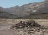
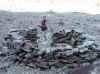
Good Look Cairn" (Nama: Heitsi-Eibib or Haitse-aibeb)
established by Pastoral Nomads in the Brandberg: Approx. 1500 A.D.: View from the West
into the Hungorob Gorge: March 2003: Erongo Region
Copyright of Photo: Dr. Klaus Dierks
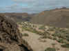
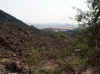
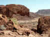
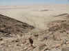
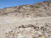
View from the East into the Ugab Valley (Boundary between Erongo
and Kunene Regions): March 2003
Copyright of Photo: Dr. Klaus Dierks
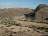
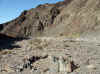
View from the East into the Ugab Valley and a Valley leading to
the Doros Crater and the Mikberg Mountains: March 2003
Copyright of Photo: Dr. Klaus Dierks
 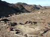
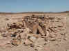
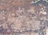
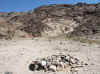
Prehistoric Stone Circle Architecture of Nomadic Pastoralists in
the Ugab Valley (Ugab Crossing)(Around 1600 A.D.): Site 1: March 2003
Copyright of Photos: Dr. Klaus Dierks
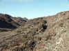
Prehistoric Pathway used by Nomadic Pastoralists in the Ugab
Valley (Ugab Crossing)(Around 1600 A.D.): Access to Site 1: March 2003
Copyright of Photo: Dr. Klaus Dierks

Prehistoric Stone Circle Architecture of Nomadic Pastoralists in
the Ugab Valley (Ugab Crossing)(Around 1600 A.D.): Site 2: March 2003
Copyright of Photo: Dr. Klaus Dierks
Prehistoric Stone Circle Architecture of Nomadic Pastoralists in
the Ugab Valley (Ugab Crossing)(Around 1600 A.D.): Site 5: March 2003
Copyright of Photos: Dr. Klaus Dierks
Prehistoric Stone Circle Architecture of Nomadic Pastoralists in
the Ugab Valley (Ugab Crossing)(Around 1600 A.D.): Site 11: March 2003
Copyright of Photo: Dr. Klaus Dierks
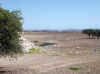
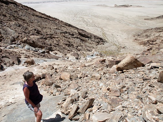
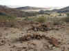
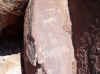
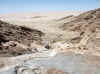
Prehistoric Site of Gai-As: Between Doros Crater and Huab River:
For Millenniums the Hunter Gatherers and later the Nomadic Pastoralists used the Waterhole
of Gai-As: Now the Hole is visited by Desert Elephants and Desert Rhinoceros: March 2003:
Kunene Region
Copyright of Photos: Dr. Klaus Dierks
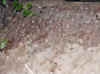 
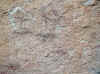
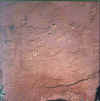
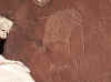
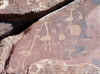
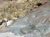
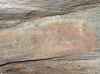
Prehistoric Site of Gai-As: Site 1: Rock Engravings by
Hunter-Gatherers: C1 to E Periods: 4400 B.C. - 1200 A.D.:
Approximately 2000 Years Old: March 2003: Kunene Region
Copyright of Photos: Dr. Klaus Dierks
 
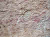
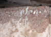
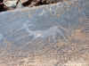
Prehistoric Site of Gai-As: Site 2: Rock Engravings by
Hunter-Gatherers: C1 to E Periods: 4400 B.C. - 1200 A.D.:
Approximately 2000 Years Old: March 2003: Kunene Region
Copyright of Photos: Dr. Klaus Dierks
   
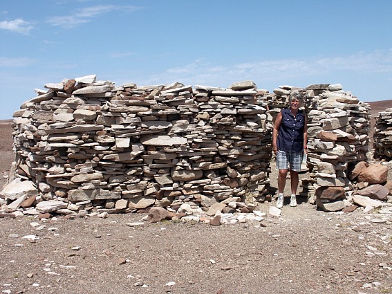
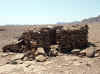
Prehistoric Site of Gai-As: Site 3: Stone Circle Architecture of
Nomadic Pastoralists: "High Buildings": Approximately between 1500 and 1900
A.D.: March 2003: Kunene Region
Copyright of Photos: Dr. Klaus Dierks
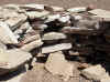
Prehistoric Site of Gai-As: Site 9: Stone Circle Architecture of
Nomadic Pastoralists: North West Settlement: Approximately between 1500 and 1900 A.D.:
March 2003: Kunene Region
Copyright of Photos: Dr. Klaus Dierks
Prehistoric Site of Gai-As: Site 6: Stone Circle Architecture of
Nomadic Pastoralists: South West Settlement: Approximately between 1500 and 1900 A.D.:
March 2003: Kunene Region
Copyright of Photos: Dr. Klaus Dierks
Prehistoric Site of Gai-As: Site 11: Stone Circle Architecture
of Nomadic Pastoralists: East Settlement: Approximately between 1500 and 1900 A.D.: March
2003: Kunene Region
Copyright of Photos: Dr. Klaus Dierks

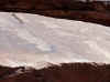
Twyfelfontein in the Kunene Region: with Africa's largest known
Collection of Rock Engravings, April 1980
Copyright of Photo: Dr. Klaus Dierks
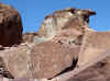
Images of the Rocky Crater of Twyfelfontein: March
2003: In 1921 Reinhardt Maack makes known his Discovery of the Petroglyphs
and Rock Paintings on the Sandstone of the Etjo Formation at Twyfelfontein (Ui-Ais)(C1 to
E periods: 4400 B.C. - 1400 A.D.). The Petroglyphs are recorded by Ernst Rudolph Scherz
from 1950 onwards. He reports that there are 2 500 Rock Engravings on more than 200
Sandstone Slabs: He also discovers some Rockpaintings housed in Sandstone Rock
Shelters
Copyright of Photos: Dr. Klaus Dierks

Twyfelfontein with pre-historic Stone Circle of Nomadic
Pastoralists (Possible Transition from Windshields to Hut Foundations: D Period between
A.D. and 1200 A.D.): Kunene Region: March 2003
Copyright of Photos: Dr. Klaus Dierks
Twyfelfontein: Rock Engravings: C1 to E Periods:
4400 B.C. - 1200 A.D.: April 1980
Copyright of Photos: Dr. Klaus Dierks
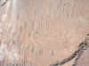   
Twyfelfontein: Rock Engravings: Later Stone Age
Hunter-Gatherer Culture: C1 to E Periods: 4400 B.C. - 1200 A.D.: Some of the
Engravings may be as old as 7 000 Years and even much older: The Abstract Designs were
probably done by earlier Artists: March 2003: Kunene Region
Copyright of Photos: Dr. Klaus Dierks
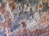
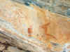
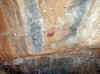
Twyfelfontein with Rockpaintings: C1 to E Periods: 4400 B.C. - 1200 A.D.: The Rockpaintings
are younger than the Rockengravings: Kunene Region: March 2003
Copyright of Photos: Dr. Klaus Dierks
 
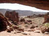
Khoichab Pan Restricted Area: Namib Desert: Kirchberg: East of
Khoichab Pan: Ascent to the Caves with San Rockpaintings: November 2002: Karas Region
Copyright of Photos: Dr. Klaus Dierks

Khoichab Pan Restricted Area: Namib Desert: Kirchberg: East of
Khoichab Pan: View from Cave 1 to the North with Khoichab Dunes in the Background:
November 2002: Karas Region
Copyright of Photo: Dr. Klaus Dierks
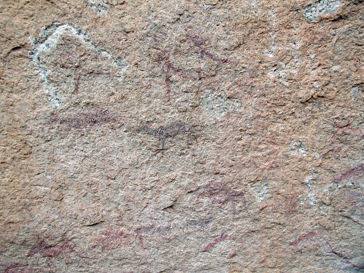
Khoichab Pan Restricted Area: Namib Desert: Kirchberg: East of
Khoichab Pan: Cave 1 with recently discovered San Rockpaintings: Estimated C2 Period: 1200
B.C. to A.D.: November 2002: Karas Region
Copyright of Photos: Dr. Klaus Dierks
Khoichab Pan Restricted Area: Namib Desert: Kirchberg: East of
Khoichab Pan: Waterhole near Cave 1: November 2002: Karas Region
Copyright of Photo: Dr. Klaus Dierks
Khoichab Pan Restricted Area: Namib Desert: Kirchberg: East of
Khoichab Pan: Ascent from Cave 1 to Cave 2: November 2002: Karas Region
Copyright of Photos: Dr. Klaus Dierks
Khoichab Pan Restricted Area: Namib Desert: Kirchberg: East of
Khoichab Pan: Cave 2 with recently discovered San Rockpaintings: Estimated C2 Period: 1200
B.C. to A.D.: November 2002: Karas Region
Copyright of Photos: Dr. Klaus Dierks

Khoichab Pan Restricted Area: Namib Desert: Kirchberg: East of
Khoichab Pan: Cave 2 with recently discovered San Rock Engraving: Estimated C2 Period:
1200 B.C. to A.D.: November 2002: Karas Region
Copyright of Photos: Dr. Klaus Dierks

Khoichab Pan Restricted Area: Namib Desert: Kirchberg: East of
Khoichab Pan: Ascent to Cave 3 from the Base: Karas Region
Copyright of Photo: Dr. Klaus Dierks
Khoichab Pan Restricted Area: Namib Desert: Kirchberg: East of
Khoichab Pan: Ascent to Cave 3: Building Remains in the Form of Stone Circles at the
Kirchberg Settlement Site built by Pastoral Nomads in the Namib: Karas Region
Copyright of Photos: Dr. Klaus Dierks
Khoichab Pan Restricted Area: Namib Desert: Kirchberg: East of
Khoichab Pan: Ascent to Cave 3: Possible Grave or a "Good Look Cairn" (Nama:
Heitsi-Eibib or Haitse-aibeb) established by Pastoral Nomads in the Namib: Karas Region
Copyright of Photo: Dr. Klaus Dierks
Khoichab Pan Restricted Area: Namib Desert: Kirchberg: East of
Khoichab Pan: Cave 3 with recently discovered San Rockpaintings: Estimated C2 Period: 1200
B.C. to A.D.: November 2002: Karas Region
Copyright of Photos: Dr. Klaus Dierks
The first contact with European visitors in the 15th
century leads to the eventual collapse of nomadic pastoralism (D Period between A.D. and
1200 A.D.). |