
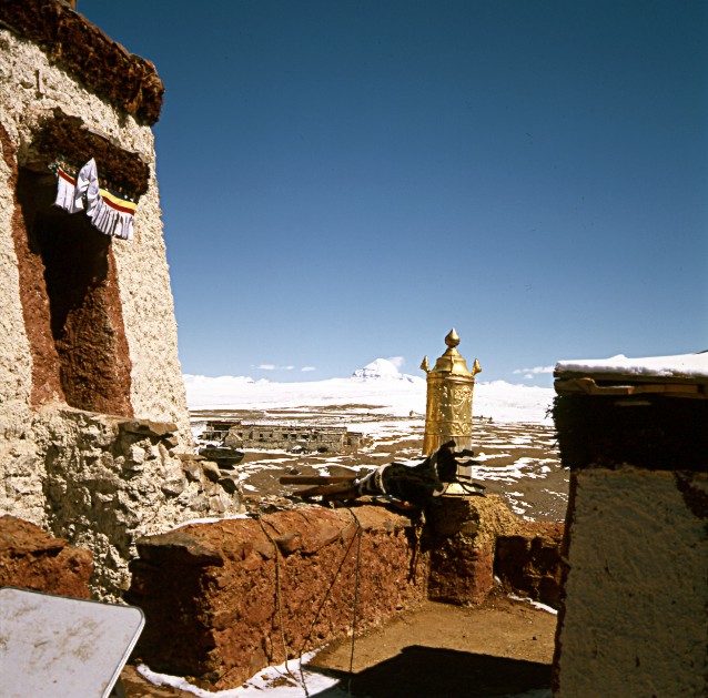
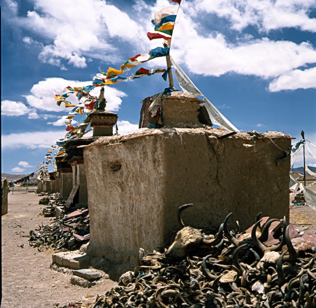
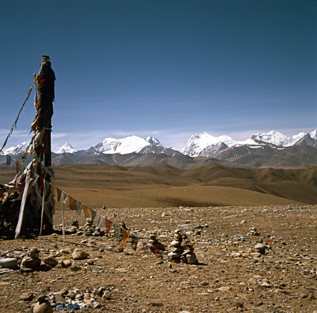
© Dr. Klaus Dierks 2004: Photo: Chuku Gompa with the Sacred Mount Kailash
PHOTO DOCUMENTATION: TIBET-EXPEDITION'1998: CROSSING
WESTERN AND NORTHERN TIBET ON THE TRAIL OF SVEN HEDIN
Klaus Dierks
© Dr. Klaus Dierks 2004-2005
© Dr. Klaus Dierks 2004: Photo: Chuku Gompa with
the Sacred Mount Kailash

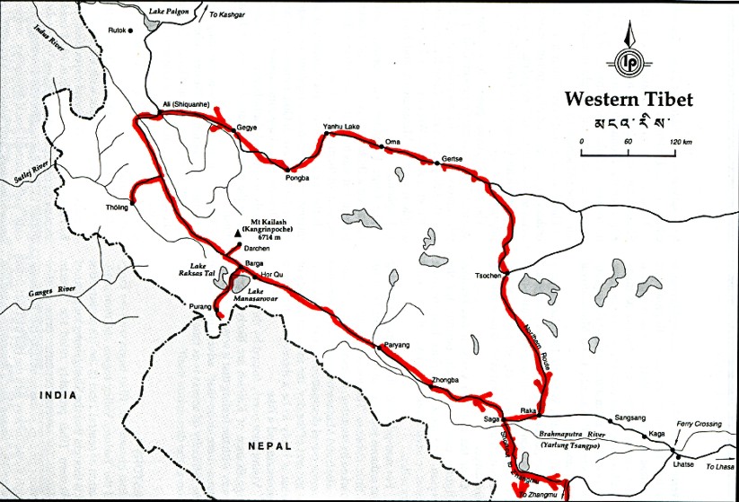
Copyright: Lonely Planet Publications, 3rd Edition, 1995
Western Tibet is the most inaccessible region of the Tibetan Autonomous Region of the Peoples Republic of China. The Chinese authorities do their best to make it even more inaccessible by putting as many hurdles as possible between individual travellers and the main attractions of the area: The sacred Mount Kailash, Lake Manasarovar, the cultural treasures of the more than one thousand years old Western Tibetan Kingdom of Guge (Tholing and Tsaparang) and the even more inaccessible Tschangtang Province in the north of Tibet. After the successful 1997 Tibet Expedition into some "forbidden areas" along the Tibetan Sikkim border, I planned to visit western and northern Tibet as an individual traveller, together with my wife, Karen Dierks, née Von Bremen and even visit some areas in northwestern Tibet, which in 1998 were still closed. The plan was to follow the trails of the Swedish Tibet explorer, Sven Hedin who explored these remote areas at the beginning of the 20th century and the Austrian mountaineer, Heinrich Harrer (Seven Years in Tibet) who fled in the 1940s from the British Prisoner-of-War Camp in Dehradun in India to Tibet and stayed there until 1950. When Sven Hedin visited western Tibet in 1908, this area was so marginalised as to almost disappear from the history and geography books. The legend of a holy mountain (Mount Kailash) and a lake (Lake Manasarovar) from which four of Asia's mightiest rivers flowed was largely ridiculed by western cartographers. When Hedin returned from his arduous journey he was able to prove that there was indeed such a holy mountain and such a lake, and that the remote western part of Tibet was in fact the source of the Tsangpo/Brahmaputra, Indus, Sutlej and Ganges (Karnali) rivers.
When in 1990 I was elected as Member of the first independent Parliament of the Republic of Namibia and appointed as a Minister of the Namibian government I was able to start working to make this plan to become a reality. In the mean time I had been to many trekking and mountaineering expeditions in many parts of the Himalaya and Karakoram and to the central and eastern parts of Tibet. Due to the fact that for many decades there was a very close relationship between SWAPO of Namibia and the Peoples Republic of Namibia, a special permit with authorisation of the Chinese Prime Minister was granted that I was able to visit as an individual tourist these areas and some still closed areas in northwestern Tibet in 1998 (from April to June 1998).
![]()
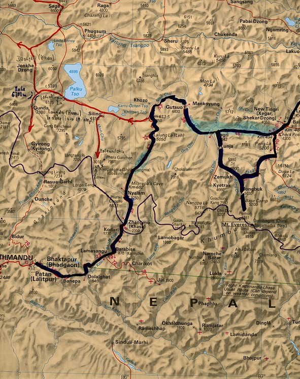
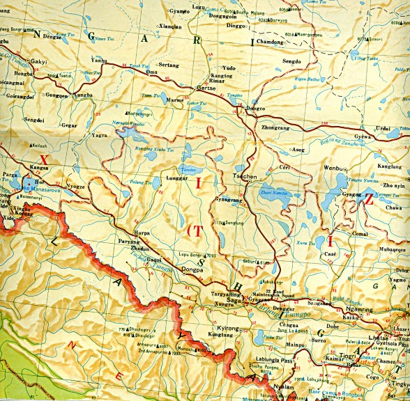
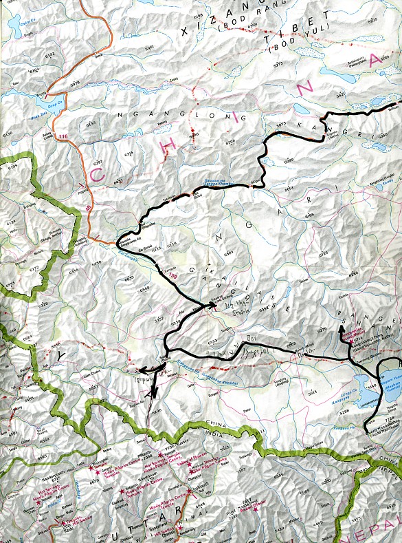
FROM ZANGHMU (KHASA) AT THE NEPAL-TIBET BORDER TO SAGA AT THE YARLUNG TSANGPO
Copyright: Edward Stanford Ltd. 1992
The following photo documentation gives an impression what we had experienced in 1998. Our
Mini-Expedition consisted of two vehicles, a Chinese Toyota Landcruiser for us and the
guide and a Chinese Dofeng truck for all our supplies for more than a month. The
expedition route took us from the capital of Nepal Kathmandu to the Tibetan frontier at
Zhangmu (Khasa) and from there to the Tibetan high plateau which we reached at Nyalam. We
crossed the first pass of more than 5 000 m, the Lalung La. From there we left the 1997
route at km 613,5 (from Lhasa) and turned to the west (red route on map). We travelled via
Siling 4 580 m (exit point to the Shisha Pangma 8 013 m) to the Paiku Tso (See) 4 595 m
and two passes (Tschakyung La 5 200 m and Ma La 5 700 m) to Gunda 3 900 m (Longda called
by Heinrich Harrer) and from there in direction to Gyirong (Kyirong which Harrer called
the "happy village"). From there we travelled back to Gunda and the Ma La to
Jonkha Dzong (which Harrer called Dzongka). There we missed the track and travelled -
wrongly - to the west, before we found the correct track again to the Lodu Loney Tso and
to Saga 4 600 m, north of the Yarlung Tsdangpo.

Zhangmu is the First Town in Tibet at the Nepalese Border: View
from Nepal (Kodari) into the Bhote Kosi Gorge and to Zhangmu in Tibet
Copyright of Photo: Dr. Klaus Dierks

Zhangmu 2 200 m in Tibet
Copyright of Photo: Dr. Klaus Dierks

The Bhote Kosi (Bö Chu) Gorge north of Zhangmu
Copyright of Photo: Dr. Klaus Dierks


Nyalam 3 750 m , the first Town on the Tibetan High Plateau
Copyright of Photos: Dr. Klaus Dierks


Milarepa's Cave at Nyalam at Km 682 (measured from Lhasa): The Buddhist-Tibetan Sect of the Kagyu-Pa (Transmitted Command)
has a Number of Branches but all go back to the Indian Masters: Naropa
and Tilopa and ultimately back to Buddha Vajradhâra
(Yogas of Naropa: Heat Yoga (Dumo) and the Yoga of the Bardo). The spiritual Founder was Marpa
and his Disciple Milarepa (1052-1135). Milarepa's most influential
Disciple was Gampopa (1079-1153) whose Disciples found three
Sub-Branches: Karma-Pa (Black Hat Sect)(Tsurphu Monastery), Drugpa
(Bhutan and Ladakh) and Drigung-Pa. Milarepa was the greatest Poet of
Tibet and lived in a Cave near Nyalam: Left Photo taken in April 1998,
Right Photo in June 1998
Copyright of Photos: Dr. Klaus Dierks
The Lalung La (Pass) 5 050 m is situated between Nyalam and the
Tibetan Village Siling to the West
Copyright of Photo: Dr. Klaus Dierks

The Lalung La: View to the South, to the Nepal Border and the
Himalaya Main Range: with Gaurisankar 7 154 m in the Rolwaling to the Right and the
Melungtse 7 181 m in the Khumbu (Nepal) to the Left
Copyright of Photo: Dr. Klaus Dierks

The Lalung La: View to the West into Tibet in Direction Siling
and Shisha Pangma 8 013 m
Copyright of Photo: Dr. Klaus Dierks

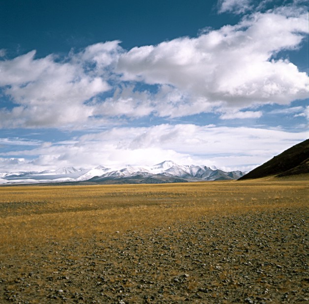
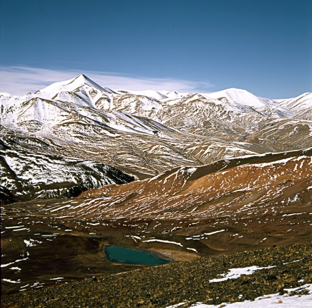
Typical Tibetan Landscape West of the Lalung La: View to North
in Direction Khomen Tso (Lake)
Copyright of Photo: Dr. Klaus Dierks

The Tibetan Village Siling (Village of the Dragon): Exit Point
to Shisha Pangma 8 013 m
Copyright of Photo: Dr. Klaus Dierks
Siling: View to the South to Shisha Pangma 8 013 m
Copyright of Photo: Dr. Klaus Dierks


Dragon Village Siling
Copyright of Photos: Dr. Klaus Dierks
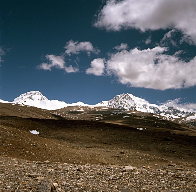
Landscape South of the Paiku Tso: View to the South towards
Nepal with Langtang Ri 7 205 m
Copyright of Photos: Dr. Klaus Dierks
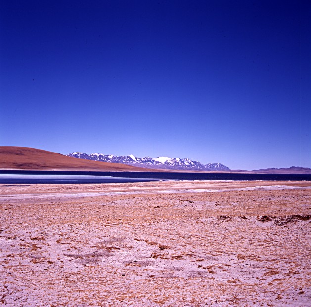
Paiku Tso 4 595 m: View to the North towards Yarlung Tsangpo
Copyright of Photo: Dr. Klaus Dierks

The Ma La between Jonkha Dzong in the North and Gunda in the
South is with 5 700 m probably the highest motorable Pass in the World: View to the South
with the Langtang Lirung 7 234 m in Nepal in the Background
Copyright of Photo: Dr. Klaus Dierks

View from the Ma La to the East in Direction Paiku Tso
Copyright of Photo: Dr. Klaus Dierks
South of the Ma La lies Gunda 3 900 m (in the Background) which
Heinrich Harrer called Longda
Copyright of Photo: Dr. Klaus Dierks

Gunda with the Langtang Lirung 7 234 m in Nepal in the
Background
Copyright of Photo: Dr. Klaus Dierks


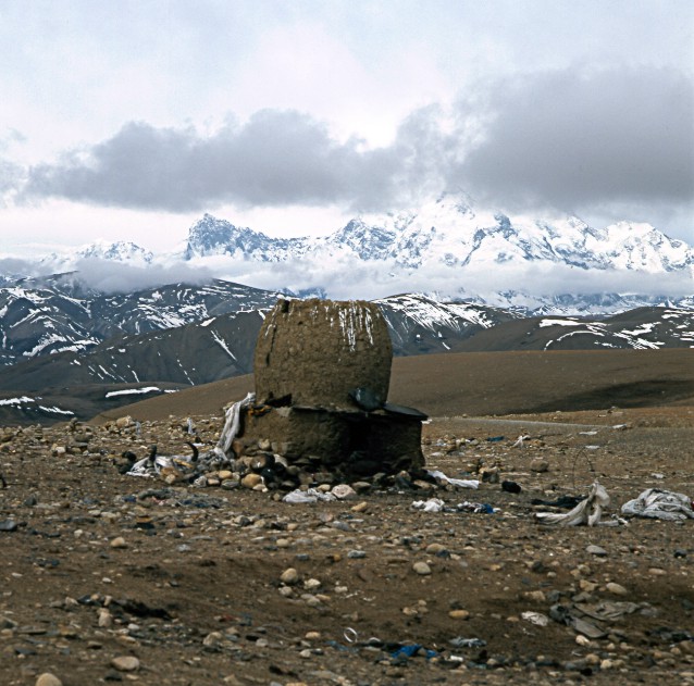
In Gunda is a Shrine which is dedicated to Tibet's Greatest
Poet, Milarepa: Trakar jaso was destroyed during the Chinese Cultural Revolution in the
1960s and is not re-built until now (1998)
Copyright of Photos: Dr. Klaus Dierks

From Gunda we try to reach Gyirong (Kyirong called by Heinrich
Harrer) through the Trisuli Bhote Kosi Gorge which flows into Nepal
Copyright of Photos: Dr. Klaus Dierks

Half Way to Gyirong, the Trisuli Bhote Kosi has destroyed the
Track and we have to return to Gunda and the Ma La in order to reach the
Yarlung Tsangpo Valley in the North
Copyright of Photo Dr. Klaus Dierks

On Route back via the Ma La 5 700m to Jonkha Dzong (Dzongka
according to Heinrich Harrer): View from the Pass to the South with Gunda in the
Background
Copyright of Photo: Dr. Klaus Dierks
Landscape near Jonkha Dzong and the Lodu Loney Tso: View to the
North into the Yarlung Tsangpo Valley and the Trans Himalaya behind it
Copyright of Photo: Dr. Klaus Dierks
Near the Lodu Loney Tso we loose our Track and deviate to the
West: The friendly Tibetan Nomad refers us back to the right Track to Saga Dzong
Copyright of Photo: Dr. Klaus Dierks

North of the Lodu Loney Tso we cross an Unnamed Pass 5 200 m:
View into the Yarlung Tsangpo Valley
Copyright of Photo: Dr. Klaus Dierks

View to the North into the Yarlung Tsangpo Valley and Saga Dzong
4 600 m
Copyright of Photo: Dr. Klaus Dierks
![]()
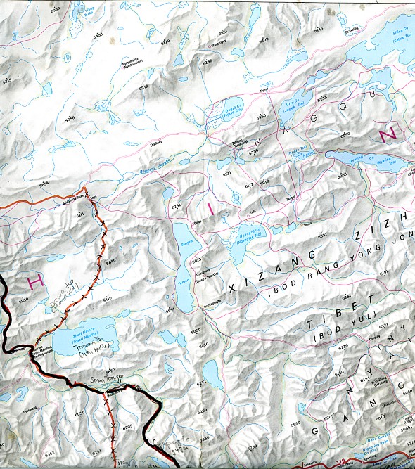
FROM SAGA DZONG ALONG THE YARLUNG TSANGPO TO THE SACRED MOUNT KAILASH AND LAKE MANASAROVAR
Copyright of Map: Mapping Bureau of Tibet Autonomous Region, 1993

Copyright of Map: Nelles Verlag
Copyright of Map: Lonely Planet Publications, 1995
The second phase of our Tibet'98 Expedition brought us from Sago Dzong along the Yarlung Tsangpo to the, for Tibetan Buddhists and Indian Hindus, Sacred Mountain of Kailash (Tibetan: Kang Rimpoche) and the Holy Lake Manasarovar. We were travelling to the Monastery Targyailing (Tarjiling) which was destroyed during the Chinese Cultural Revolution in the 1960s and was rebuilt since then. From there we went via Dongpa (also Zongba, Tsongpa) to Zhadun (Zhabdün (called by Heinrich Harrer Tradün, the "Red Monastery with the Golden Roof" (Seven Years in Tibet)). The original important town of Zhadun was completely destroyed by the Chinese authorities (except the rebuilt monastery) and re-located to Dongpa. Via Paryang (called Gyabnak by Harrer) our route brought us via Truksum (Heinrich Harrer) to Samsang (Schamthsang) and Tsesum. Although it is already middle of May, the Schamthsang plains and the Kailash areas are still covered with thick snow. This winter (until June 1998) western Tibet experienced the heavist snowfalls in human memory. We saw thousands of dead Kiangs (Tibet's wild horses) on the Schamthsang plains who died in the heavy snow. We visited the source of the main tributary to the Matsang Tsangpo (Maquan He). We crossed the Mayum La (Maryum La) at 5 151 m, the watershed between Matsang Tsangpp and Sutlej River which was discovered by Sven Hedin in 1906/07. We reached the Kongyu Tso (Kunggyü Co), the source of the Sutlej River. Via Lulung (Lhölung) at the western foot of the Mayum La and Dakacheng (Togqęn or Thokschen) we reached Hor near the MapamYumtso or Manasarovar Lake. From Darchen (Daerzheng) at the foot of the sacred Mount Kailash 6 714 m we did the Kailash Pilgrimage Circuit (Kailash Kora) to Chuku Gompa, visited the Manasarovar Lake with several Tibetan monasteries (Chiu Gompa) and Burang or Purang (Tagla Kbar) at the foot of majestic Gurla Manadata 7 728 m near the Nepalese border.

The Monastery Tardjiling (Targyailing) Gompa, approximately 20
km west of Saga Dzong: The Gompa was destroyed during the Chinese Cultural Revolution
during the 1960s but rebuilt since then
Copyright of Photo: Dr. Klaus Dierks

The Liasi Plains are situated about 100 km west of Saga Dzong:
In the South the Himalaya Main Range and Border to Nepal: From the Left to Right: Himal
Chuli 7 893 m, Manaslu 8 163 m, Annapurna Range with Annapurna I 8 091 m and Dhaulagiri
Group 8 167 m to the extreme Right
Copyright of Photo: Dr. Klaus Dierks
The important Tibetan Administrative Centre of Tradün (Zhadun
or Zhabdün) was destroyed by the Chinese Administration in the 1980s and re-located to
Dongpa in the East: View to the South West to the Dhaulagiri and Nilgiri Ranges in Nepal
Copyright of Photo: Dr. Klaus Dierks


The Gompa Tradün which Heinrich Harrer called the "Red
Monastery with the Golden Roof" (Seven Years in Tibet))
Copyright of Photos: Dr. Klaus Dierks


102 km West of Liasi lies Shuo with the upper Reaches of the
Yarlung Tsangpo, here called Matsang Tsangpo (Maquam He) between the Sand Dunes: View to
the South to the Nepalese Border Mountains into the Dolpo
Copyright of Photos: Dr. Klaus Dierks
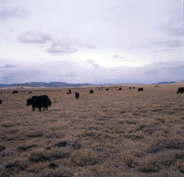
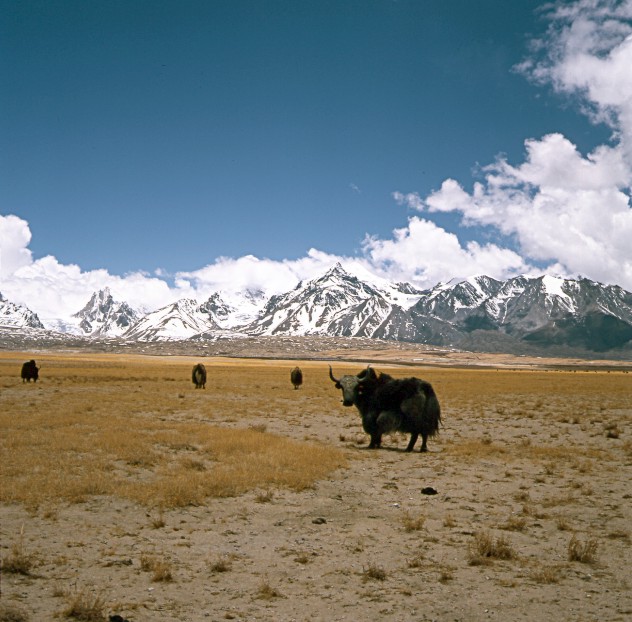
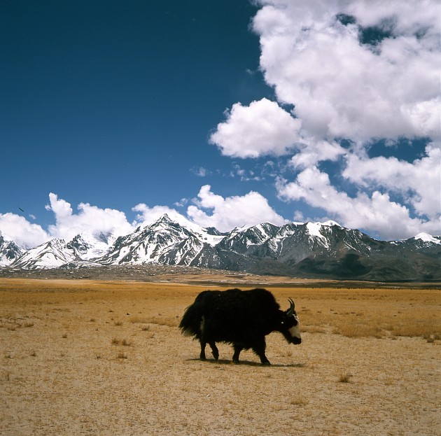
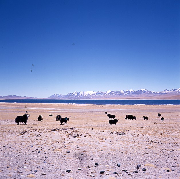
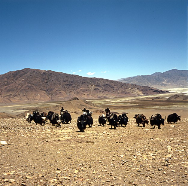
Yaks West of Paryang with View to the Northwest into Direction
of the Matsam Tsangpo Source and the Trans Himalaya
Copyright of Photo: Dr. Klaus Dierks

Paryang Gompa: Paryang was called Gyabnak by Heinrich Harrer :
To the Right a Kailash Pilgrim from Eastern Tibet (Kham) who walked five Months to Paryang
Copyright of Photos: Dr. Klaus Dierks
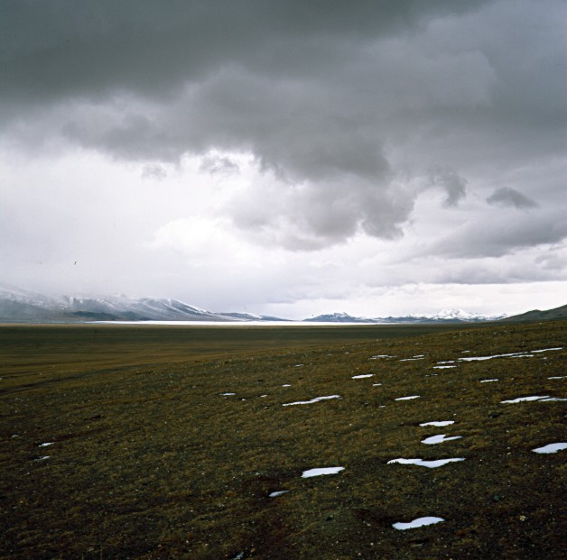
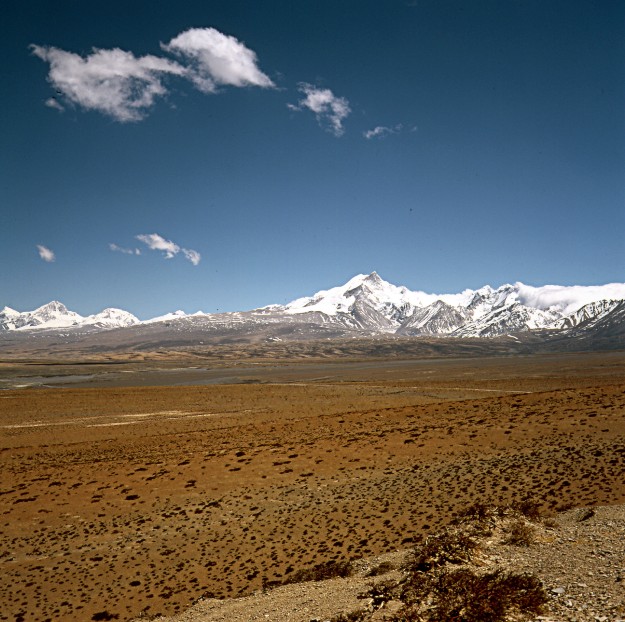
The Schamthsang Plains: View to the North into the Trans
Himlaya, also called Kailash Range (in the old Times Sven Hedin Range): Peaks between 6
309 m and 6 450 m
Copyright of Photo: Dr. Klaus Dierks

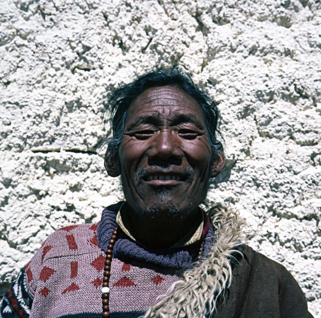
A Tibetan who we met near Schamthsang
Copyright of Photo: Dr. Klaus Dierks

Near Tsesum, at the Foot of the Maryum La (Mayum La), is the
Source of the Matsam Tsangpo (Maquam He)
Copyright of Photo: Dr. Klaus Dierks
Near Lhölung (Lulung) at the Western Foot of the Maryum La 5
151 m: Watershed between Matsam Tsangpo (Maquam He) and Sutlej River which has its source
in the Kongyu Tso (Lake) in the Background: The Watershed between Matsam Tsangpo and
Sutlej was identified by Sven Hedin in 1906/07
Copyright of Photo: Dr. Klaus Dierks
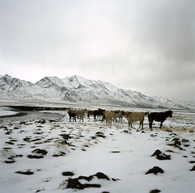
Near Hor at the Northeastern Corner of the Manasarovar Lake:
View to the North into the Trans Himalaya and the Sutlej River behind the Horses
Copyright of Photo: Dr. Klaus Dierks

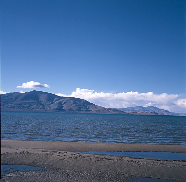
View from Chiu Gompa onto the Holy (for Buddhists and Hindus)
Manasarovar Lake (Mapam Yumtso): View to the Southeast to Nepal
Copyright of Photo: Dr. Klaus Dierks

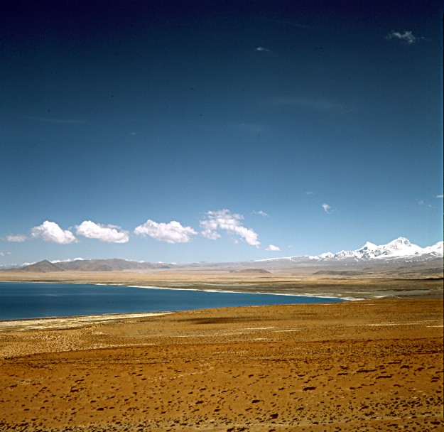
Manasarovar Lake: View to the South with Gurla Mandhata 7 728 m
North of the Tibet-Nepal Border: May, 10th 1998
Copyright of Photo: Dr. Klaus Dierks


Manasarovar Lake: View to the South to the Tibet-Nepal Border
Copyright of Photos: Dr. Klaus Dierks

Manasarovar Lake: View from Chiu Gompa to the South to the
Tibet-Nepal Border
Copyright of Photo: Dr. Klaus Dierks

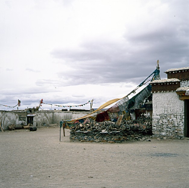
On the Western side of Manasarovar Lake lies the Monastery Chiu
Gompa
Copyright of Photos: Dr. Klaus Dierks


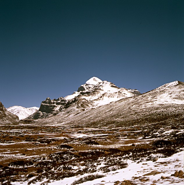
First Glimpse from Chiu Gompa to the Sacred Mount Kailash (Kang
Rimpoche) 6 714 m: View to the North
Copyright of Photos: Dr. Klaus Dierks

On the Roof of Chiu Gompa wwith View to the Sacred Mount Kailash
to the North
Copyright of Photos: Dr. Klaus Dierks

From the Western Shore of the Manasarovar Lake (View to the
South in Direction Nepal) we travel to the South via Rakas Tal and the Gurla Mandhata La
to Purang Tagla Khar near the Nepalese Border
Copyright of Photo: Dr. Klaus Dierks


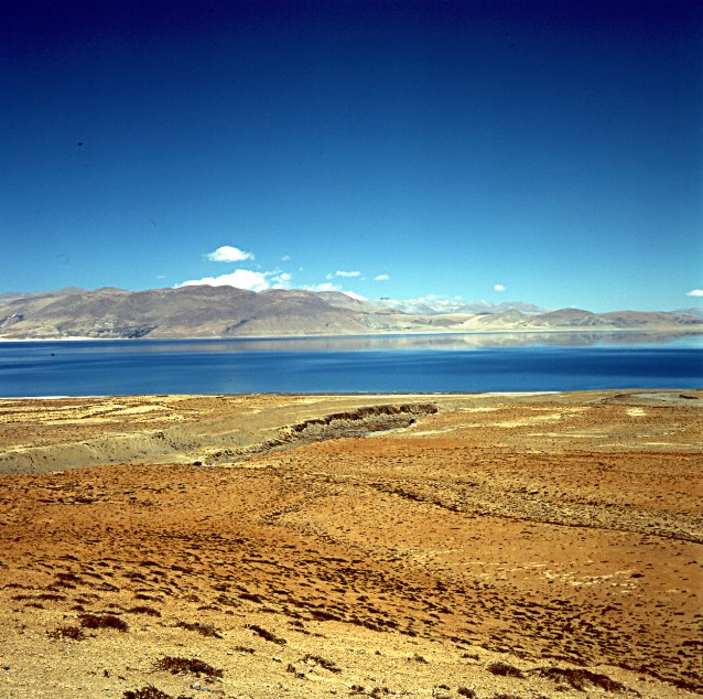
The Most Western of three Holy Kailash Lakes is Rakas Tal or
Langngag Tso: View to the West into the Upper Sutlej Valley in Direction Gartok
Copyright of Photos: Dr. Klaus Dierks


South of Rakas Tal lies the Gurla Mandhata La 5 320 m at the
Western Foot of Gurla Mandhata 7 728 m: View to the South in Direction Purang and Nepal
Copyright of Photos: Dr. Klaus Dierks


Purang Tagla Khar (Burang) near the Corner of Three Countries:
Tibet, Nepal and India
Copyright of Photos: Dr. Klaus Dierks

Manasarovar Lake on our Way to the Mount Kailash: View to the
South to Gurla Mandhata
Copyright of Photo: Dr. Klaus Dierks

Manasarovar Lake: View to the East into the Changla Himal at the
Tibet Nepal Border
Copyright of Photo: Dr. Klaus Dierks


View to the Sacred Mount Kailash (Kang Rimpoche) 6 714 m from
the South: Left Photo shows the Northeastern Corner of the Lake Rakas Tal
Copyright of Photos: Dr. Klaus Dierks

Darchen (Daerzheng) is the Point of Exit to the Sacred Mount
Kailash (Kang Rimpoche) for the Kailash Pilgrimage Circuit (Kailash Kora)
Copyright of Photo: Dr. Klaus Dierks
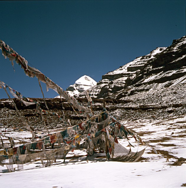


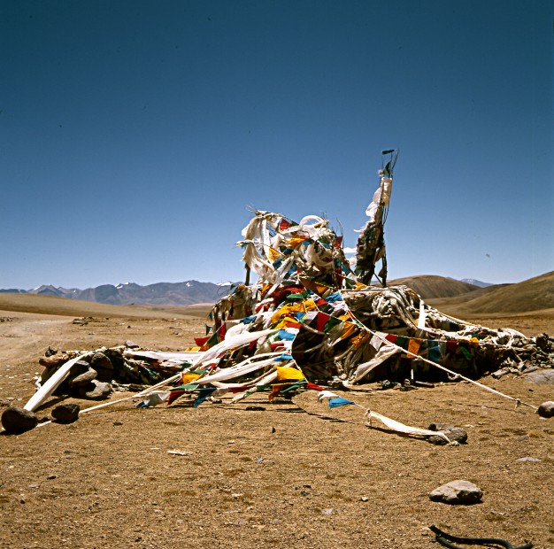
The Kailash Kora starts nothwest of Darchen. The 53-km Kailash
Kora is the holiest of all Tibet's Pilgrimages. Like all other Pilgrimage Circuits, the
Kora describes a clockwise Circumambulation of the Mountain and includes various Sites of
Religious Significance along the Way. If you meet Pilgrims coming from the Opposite
Direction, they are likely to be Followers of the Pre-Buddhist Tibetan Bön Faith, who
make an anti-clockwise Circumambulation of the Mountain. The first of the Kora Stations is
the Tarboche Gate.
Copyright of Photos: Dr. Klaus Dierks


From Tarboche we follow the Lha Chu Valley to a Bridge which is
one of the most beautiful Sections of the whole Kora, with Kailash towering above. From
the Bridge, it is possible to walk up on a steep Climb to the Monastery Chuku Gompa 5 600
m perched high on the Hill that rise from the Left Bank of the Lha Chu. Due to the
unnormal high Snowfalls in Western Tibet still persisting into the Summer Months 1998, it
was for us not possible to complete the whole Kora, because no Pack Animals or Porters
were able to cross the Dolma La 5 600 m due to the deep Snow. Our Kora ended at Chuku
Gompa.
Copyright of Photos: Dr. Klaus Dierks


View from Chuku Gompa to the South in Direction Tarboche,
Darchen and the Rakas Tal with the Himalaya Main Range at the Nepal/India Border in the
Background
Copyright of Photos: Dr. Klaus Dierks


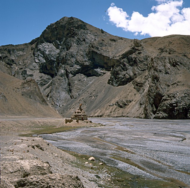
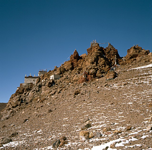
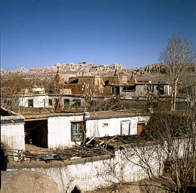
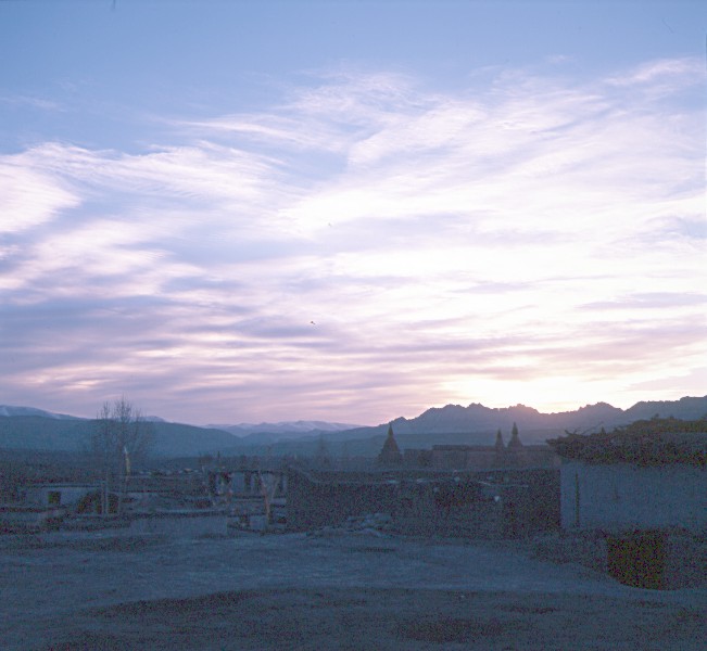
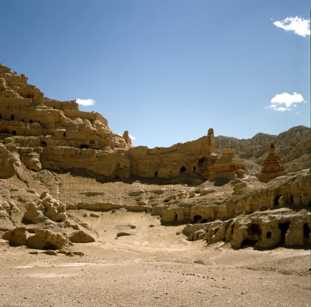
Chuku Gompa 5 600 m is probably the most beautiful
situated of all Tibetan-Buddhist Monasteries
Copyright of Photos: Dr. Klaus Dierks
![]()
FROM THE SACRED MOUNT KAILASH ALONG THE GAR TSANGPO TO GARTOK AND SHIQANHE (SENGGEZANPO OR ALI) AT THE INDUS RIVER NEAR THE BORDER BETWEEN LADAKH AND TIBET
Copyright of Map: Nelles Verlag
Copyright of Map: Lonely Planet Publications, 1995
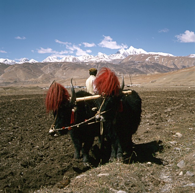
The third phase of our Tibet'98 Expedition brought us from the Sacred Mountain of Kailash and the Lake Manasarovar to the isolated areas of West Tibet. We firstly saw for hours the Kailash in the North east. We followed the Gar Tsangpo, one of the main tributaries of the Indus River. We travelled via Möntshe (Moincęr or Misar) to Bar where we left the track along the Gar Tsangpo and turned to the south. We crossed a high Pass, Nunga La 5 134 m, and went parallel to the Sutlej River (Xiangquan He or Langgchen Khamba) to the west. Turning south into the Sutlej Valley we had stunning views to the south into the Sutlej Gorge, the deepest gorge in the world, with the Indian Himalayas, towered by Kamet 7 756 m, in the background. Thöling (Tsada) and Tsaparang were the centres of the ancient Buddhist Kingdom of Guge which restored the Tibetan Buddhism in the 9th century. The monastic complex at Thöling was founded by Ringchen Zangpo, a monk who worked under the patronage of the Guge King Yeshe Ö in the 10th century AD.Thöling was once Western Tibet's most important monastic complex, and was still functioning in 1966 when the Guards of the Chinese Cultural Revolution shut down operations. Unfortunately all the Buddhist art work in the Tibetan monasteries of Thöling and Tsaparang were destroyed by the Cultural Revolution in the 1960s. Fortunately the art work is till preserved in the former Tibetan Polity of Spiti which formed part of the Guge Kingdom and is now part of India. Spiti lies just south of the present-day (approximately 40 km) Tibet-India Border. As comparison the wall paintings of some monasteries in Spiti, which I visited in 2003, will be shown in this documentation. From Tholing we travelled back into the Gar Tsangpo valley in the north, and joined the east-west track at Namru. Via Gartok, the old Tibetan administrative centre of West Tibet, we reached Shiquanhe (Senggezanpo or Ali) where the Gar Tsangpo joins the Indus which sources north of Mount Kailash. Ali is situated near the border between Tibet and Ladakh.


We travel along the Gar Tsangpo and see for Hours the Mount
Kailash in the Northeast
Copyright of Photos: Dr. Klaus Dierks

The Upper Reach of the Gar Tsangpo, important Tributary of the
Indus River: View to the Southeast with Rakas Tal and Gurla Mandhata in the Background
Copyright of Photo: Dr. Klaus Dierks

The Upper Reach of the Gar Tsangpo, important Tributary of the
Indus River: View to the West in Direction Möntshe
Copyright of Photo: Dr. Klaus Dierks


Our Camping Site near Möntshe (Moincęr or Misar): View to the
South
Copyright of Photos: Dr. Klaus Dierks
The Nunga La 5 134 m between the Gar Tsangpo and the Sutlej
Valley: View to Southeast
Copyright of Photo: Dr. Klaus Dierks


View into the Sutlej Gorge: Deepest Canyon in the World, Deeper
than the Grand Canyon in the USA and the Fish River Canyon in Namibia: View to the South
to the Indian Himalaya: Towered by Kamet 7 756 m to the Right and to the Left: Nanda Devi
7 817 m more in the Background
Copyright of Photos: Dr. Klaus Dierks
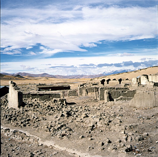
Thöling (Tsada) and Tsaparang in the Sutlej Valley were the
Centres of the ancient Buddhist Kingdom of Guge which restored the Tibetan Buddhism in the
9th Century. The Monastic Complex at Thöling was founded by Ringchen Zangpo, a Monk who
worked under the Patronage of the Guge King Yeshe Ö in the 10th Century AD.Thöling was
once Western Tibet's most important Monastic Complex, and was still functioning in 1966
when the Guards of the Chinese Cultural Revolution shut down Operations. Unfortunately all
the Buddhist Art Work in the Tibetan Monasteries of Thöling and Tsaparang were destroyed
by the Cultural Revolution in the 1960s: Photos show what was left of the Thöling
Monastic Complex
Copyright of Photos: Dr. Klaus Dierks

Tsaparang also was destroyed by the Cultural Revolution in the
1960s, although it has been gracefully falling into Ruin since its Slide from Prominence
in the 17th Century: The Monastic Caves extend along a Ridge with the two Main Areas of
Interest: The Red (Lakhang Marpo) and White (Lhakang Karpo) Chapels and the Tsaparang
Dzong
Copyright of Photos: Dr. Klaus Dierks

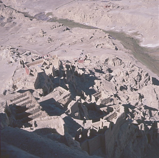

Tsaparang Dzong is entered via a Tunnel and Stairway in the
North-East Section of the Fortress Complex which leads to a Platform with Stunning
Views: View on the Tsaparang Temples (Left) and to the North to the Sutlej Valley and the
Trans Himalaya (Right)
Copyright of Photos: Dr. Klaus Dierks

Buddha Sakyamuni in the White Chapel (Lhakang Karpo)(No Flash
allowed): One of the few Wall Paintings left by the Cultural Revolution
Copyright of Photo: Dr. Klaus Dierks

The Remainders of the Chinese Cultural Revolution in the Red
Chapel (Lhakang Marpo)(No Flash allowed)
Copyright of Photo: Dr. Klaus Dierks
BUDDHIST ART WORK IN THE FORMER SPITI POLITY WHICH WAS PART OF THE WEST TIBETAN KINGDOM OF GUGE WHICH WAS NOT AFFECTED BY THE CHINESE CULTURAL REVOLUTION IN THE 1960s BECAUSE IT NOW FORMS PART OF INDIA
Dankar Gompa is like other Spiti Gompas one of
the oldest (maybe the oldest) Tibetan Buddhist Monasteries in Western Tibet (formerly
belonging to the Guge Kingdom). Dankar was also the first Capital of the Spiti Polity
View from the Dankar Gompa to the East into the
Spiti River Valley and in Direction Tabo and Sutlej Valley towards the Tibetan Border
Dankar Gompa: The inner Yard of the Monastery
Dankar Gompa: The Lhakang (Prayer Hall) of the
Monastery
Dankar Gompa: More than 1 000 Years old Buddhist
Frescoes (Guge Culture) in the Lhakang (Prayer Hall) of the Monastery
Lalung Gompa is like other Spiti Gompas one of
the oldest Tibetan Buddhist Monasteries in Western Tibet (formerly belonging to the Guge
Kingdom).
Lalung Gompa: More than 1 000 Years old Buddhist
Frescoes (Guge Culture) in the Lhakang (Prayer Hall) of the Monastery. The
Lhakang has no natural Light Source, therefore my Wife (to the left), Karen
Dierks, née von Bremen, has to keep the Torch in order to focus on the Frescoes (for the
first Time published)
Lalung Gompa: More than 1 000 Years old Buddhist
Frescoes (Guge Culture) in the Lhakang (Prayer Hall) of the Monastery
Lalung Gompa: Entrance Hall
Kungri Gompa is situated in the Pin Valley (in
the Background). The Pin River originates from the Pin Parbati La (5 319 m) which leads
into the Kulu Valley in the West. Kungri Gompa is like other Spiti Gompas one of the
oldest Tibetan Buddhist Monasteries (more than 1 000 Years old) in Western Tibet (formerly
belonging to the Guge Kingdom).
Kungri Gompa: The Lhakang (Praying Hall)
Kungri Gompa: More than 1 000 Years old Buddhist
Frescoes (Guge Culture) in the Lhakang (Prayer Hall) of the Monastery: To the Right the
Kanjur (108 Volumes of the Tibetan Buddhist "Bible") |

From the Sutlej Valley we travel back to the
North to the Gar Tsangpo Valley: View to the South in Direction Thöling and the Indian
Himalaya with the Towering Kamet 7 756 m in the Middle
Copyright of Photo: Dr. Klaus Dierks
Gartok in the Gar Tsangpo Valley is the Former
Administrative Centre of West Tibet: View to the South
Copyright of Photo: Dr. Klaus Dierks

Landscape near Garyacsa west of Gartok: View to the West
Copyright of Photo: Dr. Klaus Dierks

Landscape near Gar (Gunsa) west of Garyacsa: View
to the South
Copyright of Photo: Dr. Klaus Dierks

Shiquanhe (Senggezanpo or Ali) is present-day a modern Chinese
Town. It is situated where the Gar Tsangpo joins the Indus which sources north of Mount
Kailash. Ali lies near the Border between Tibet and India (Ladakh)
Copyright of Photo: Dr. Klaus Dierks
![]()
FROM THE INDUS RIVER AT THE BORDER BETWEEN LADAKH AND TIBET THROUGH TIBET'S REMOTE NORTHERN PROVINCE TSCHANGTHANG BACK TO SAGA AT THE YARLUNG TSANGPO

Copyright of Maps: Nelles Verlag
Copyright of Map: Lonely Planet Publications, 1995
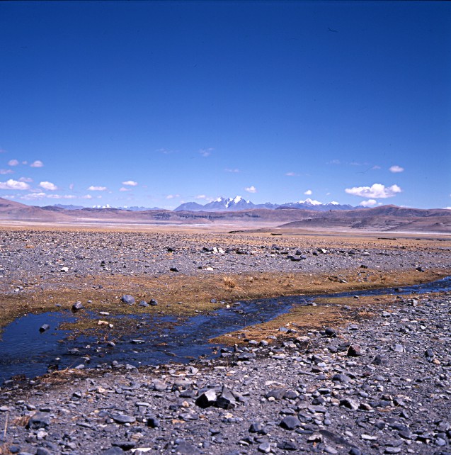
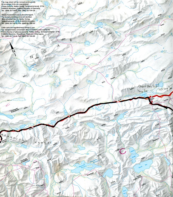
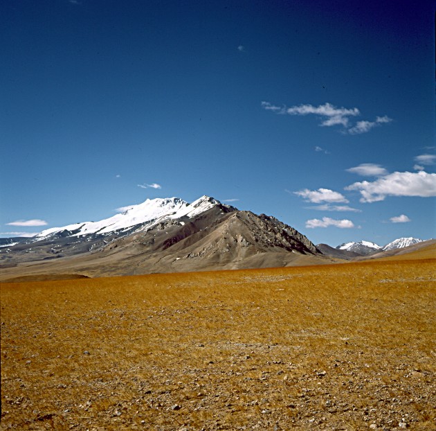
From Shiquanhe (Senggezanpo or Ali) we followed on our fourth section the course of the Indus River for about 100 km. There the road turns into a north eastern direction to Yuenkotan and further to Zoco (Sotso). We followed the course of the River Shiquan He (Sengge Khamba) to Gëgyai (112 km from Ali). In Gëgyai we left Tibet's Western Province Ngari and entered Tibet's Northern Province Tschanthang which lies north of the Trans Himalaya. Some kilometres east of Gëgyai the road turns to the north into the direction of the mountain range Ngan Glong Kangri. Pongba is situated 105 km from Gëgyai. Travelling to Pongba we crossed the Ngan Glong Kangri range on a high pass. From there the road runs more or less in a west-easterly direction. Pongba is a dismal little place populated by "alcoholic Tibetans, mad dogs and broken beer bottles". From Pongba to Gertse the distance is 180 km. First we passed a ravine and crossed a high pass before we travelled along two salt lakes, the first is Yanhu Tso which has a small salt-mining community at its western end. Via Oma we travelled to Gęrzę or Gertse, the most northern point we reached in the Tschangthang Province. From Gertse we went further east to a another salt lake, Dong Tso. From there the east-west road turns in a south-easterly direction to Tsochen near the Tschari Namtso Lake. The road to Tsochen is a bumpy, arduous ride. At Tsochen we found a well preserved monastery Mendong Gompa and, here in the middle of nowhere a digital telephone exchange where we could phone Namibia in an instant. The road from Tsochen to Saga where the Tschangthang Road joins the road from Lhasa to Saga is in a shocking state of repair. The one compensation is the frequently breathtaking scenery the road winds through. Some 150 km south of Tsochen the road passes a series of lakes, their waters a miraculous shade of the deepest blue imaginable. Shortly before joining the Lhasa to Saga road we experienced some hot springs and geysers. In Saga we closed our circuit through western and northern Tibet. At many places we touched Sven Hedin's research expeditions he undertook in the years 1906/07.

Copyright: Lonely Planet Publications, 1995

The Indus (Siquen He or Sengge Khamba) approximately 55 km
northeast of Ali
Copyright of Photo: Dr. Klaus Dierks

In Yuenkotan we have a View into Tibet's Western Province Ngari:
View to the East
Copyright of Photo: Dr. Klaus Dierks

In Gëgyai (112 km northeast of Ali) we left Tibet's Western
Province Ngari and entered Tibet's Northern Province Tschangthang
Copyright of Photo: Dr. Klaus Dierks

A High Unnamed Pass east of Gëgyai in the Tschangthang
Copyright of Photo: Dr. Klaus Dierks

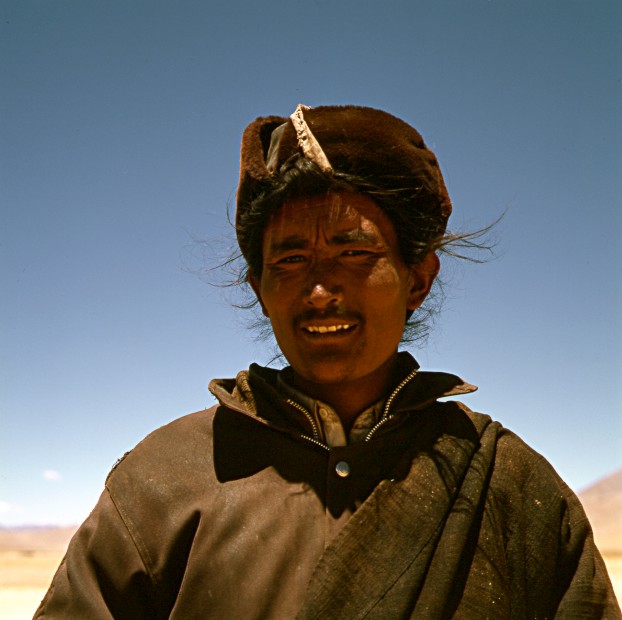
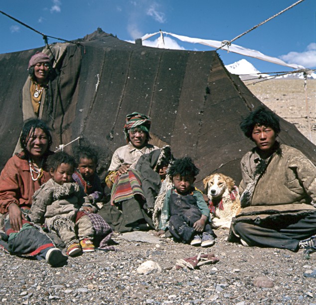
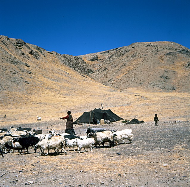
The Tibetan Nomads of the Tschangthang, west of Pongba
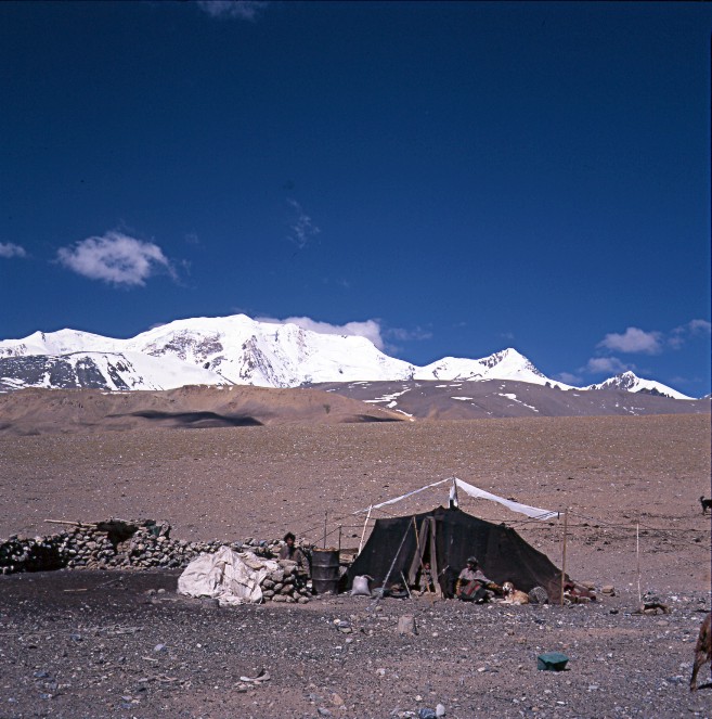
Copyright of Photo: Dr. Klaus Dierks

Pongba in the Tschangthang
Copyright of Photo: Dr. Klaus Dierks

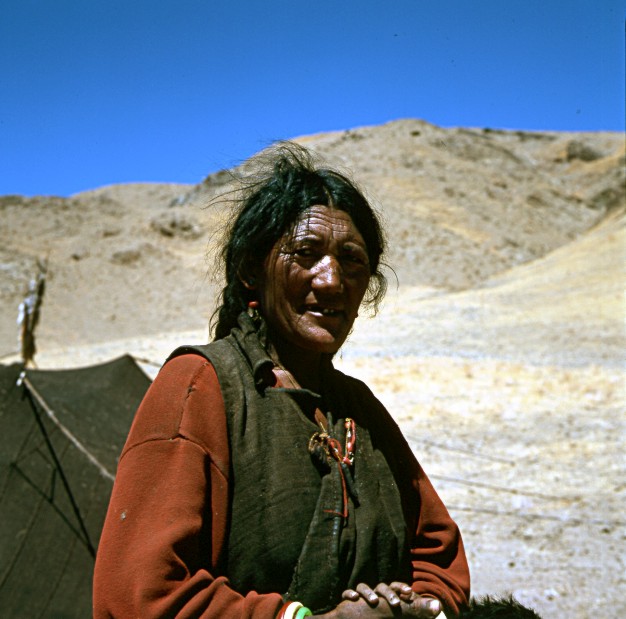
Tibetan Nomad at the Yanhu Salt Lake in the Tschangthang
Copyright of Photo: Dr. Klaus Dierks

Tschangthang Landscape west of Oma: View to the East
Copyright of Photo: Dr. Klaus Dierks

Oma: View to the South
Copyright of Photo: Dr. Klaus Dierks


Gęrzę or Gertse is an Important Administrative Centre in the
Tschangthang
Copyright of Photos: Dr. Klaus Dierks
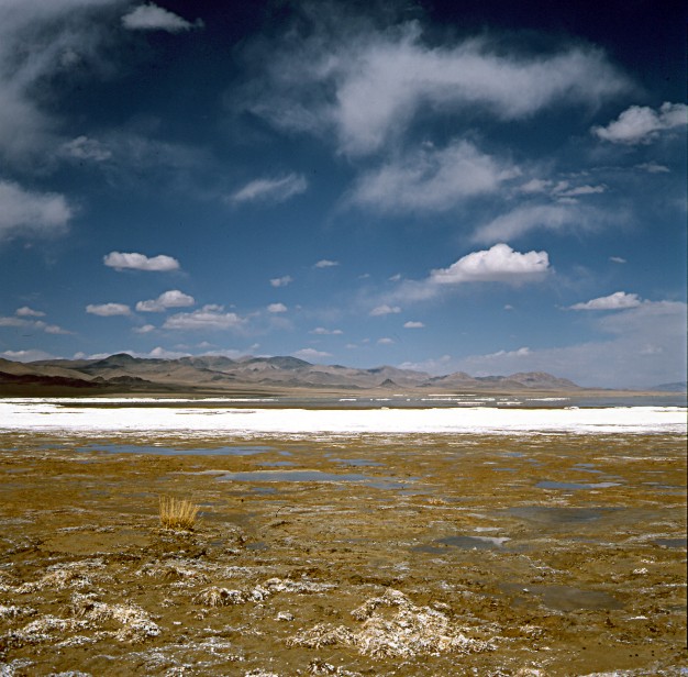
The Tsong Tso Salt Lake was discovered by Pandit Nain Singh in
the 19th Centrury and re-discovered by Sven Hedin in 1906/07
Copyright of Photo: Dr. Klaus Dierks
Landscape southeast of the Tsong Tso Salt Lake: View to the East
Copyright of Photo: Dr. Klaus Dierks

Nomads of the Tschangthang between the Tsong Tso Salt Lake and
the Dawa Tso (Moon Lake) with an Unnamed High Peak 6 430 m in the Background
Copyright of Photos Dr. Klaus Dierks

Dawa Tso (Moon Lake) in the Tschangthang: View to the West
Copyright of Photo: Dr. Klaus Dierks
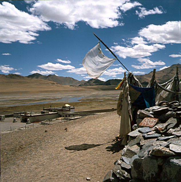

Tsochen with the Famous Mendong Gompa is an Important
Administrative Centre in the Tschangthang: Tsochen is situated near to the Tchari Namtso
which Sven Hedin called Teriman Tso
Copyright of Photos: Dr. Klaus Dierks
The Gyagong La 5 490 m forms the Border between the Tschangthang
and the Trans Himalaya which Sven Hedin called the Trans Himalaya Pass: View to the South
into the Trans Himalaya
Copyright of Photo: Dr. Klaus Dierks

The Daja Tso is one of the many Trans Himalaya Lakes, their
Waters a miraculous Shade of the Deepest Blue imaginable: View to the West
Copyright of Photos: Dr. Klaus Dierks


Approximately 20 km north of Raka (Raga) where
the Tschangthang Track meets the Lhasa to Saga Road, we experienced some Hot Springs and
Geysers
Copyright of Photos: Dr. Klaus Dierks

Approximately 10 km west of Raga we crossed a more than 5 000 m
Pass to the West in Direction Saga where we closed our circuit through Western (Ngari) and
Northern (Tschangthang) Tibet
Copyright of Photo: Dr. Klaus Dierks
![]()
FROM TIBET'S REMOTE NORTHERN PROVINCE TSCHANGTHANG AND FROM SAGA AT THE YARLUNG TSANGPO BACK TO NEPAL WITH A TREK TO THE SHISHA PANGMA (XIXAPANGMA FENG OR GOSAINTHAN)(8 013 m) BASE CAMP (5 095 m)
Copyright: Edward Stanford Ltd. 1992
From Saga at the Yarlung Tsangpo we followed on our fifth and last section of our Tibet'98 Expedition the already known tracks back to the Paiko Tso, Siling, the Lalung La 5 050 m, Nyalam and back to the Nepalese Border at Zanghmu. From Siling we undertook a trek to the Shisha Pangma (Xixapangma Feng or Gosainthan)(8 013 m) Base Camp (5 095 m).
Nomads at an Unnamed Pass 5 200 m south of the
Yarlung Tsangpo at Saga
Copyright of Photos: Dr. Klaus Dierks


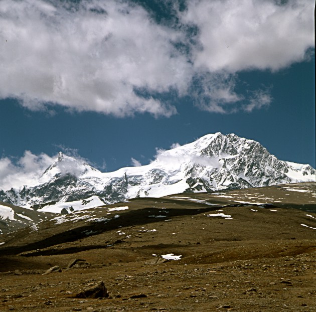
View to the South to the Nepalese Border to the Gang Benchnen 7
295 m
Copyright of Photos: Dr. Klaus Dierks
View to the East to the Paiku Tso with Cho Oyu 8 201 m in the
Background
Copyright of Photo: Dr. Klaus Dierks

View to the Southeast to the Paiku Tso with Shisha Pangma
(Xixapangma Feng or Gosainthan)(8 013 m) in the Background
Copyright of Photo: Dr. Klaus Dierks
View to the North to the Paiku Tso
Copyright of Photo: Dr. Klaus Dierks


View to the South to the Shisha Pangma (Xixapangma Feng or
Gosainthan)(8 013 m): Nomads at the Beginning of our Trek which commenced at Siling
Copyright of Photos: Dr. Klaus Dierks

View to the South to the Shisha Pangma with the nearly 8 000 m
high Molamentschin to the East (Left) and the nearly 8 000 m high Risum to the West
(Right): From Shisha Pangma Base Camp 5 095 m
Copyright of Photo: Dr. Klaus Dierks

View to the South to the Shisha Pangma with the nearly 8 000 m
high Molamentschin to the East: From Shisha Pangma Base Camp 5 095 m
Copyright of Photos: Dr. Klaus Dierks

View to the South to the Shisha Pangma with the nearly 8 000 m
high Risum to the West: From Shisha Pangma Base Camp 5 095 m
Copyright of Photo: Dr. Klaus Dierks


View to the South to the Shisha Pangma from Molamentschin to the
East to Risum to the West: From Shisha Pangma Base Camp 5 095 m
Copyright of Photos: Dr. Klaus Dierks

On our Way back to Nepal: View to the South from the Lalung La 5
050 m to the Himalaya Main Range: Rolwaling with Gaurisankar 7 134 m to the Right and
Melungtse 7 181 m in the Khumbu to the Left
Copyright of Photos: Dr. Klaus Dierks

On our Way back to Nepal: View to the South from the Lalung La 5
050 m to the Himalaya Main Range in Direction Cho Oyu 8 201m in the Khumbu in Nepal
Copyright of Photo: Dr. Klaus Dierks

On our Way back to Nepal: View from the Southern Slopes of the
Lalung La 5 050 m to the Himalaya Main Range in Direction Rolwaling in Nepal
Copyright of Photo: Dr. Klaus Dierks

On our Way back to Nepal: View from the Southern Slopes of the
Lalung La 5 050 m to the Himalaya Main Range in Direction Nyalam and the Langtang Himal in
Nepal
Copyright of Photo: Dr. Klaus Dierks

On our Way back to Nepal: View to the South in Direction Nyalam
and the Langtang Himal in Nepal: The Summer has arrived on the Tibetan Highlands in June
1998
Copyright of Photo: Dr. Klaus Dierks

On our Way back to Nepal: View to the South in Direction Nyalam
and the Langtang Himal in Nepal: At Milarepa's Cave Gompa our Trekking Expedition to
Western and Northern Tibet'98 is coming to an End
Copyright of Photo: Dr. Klaus Dierks
![]()


