

THE HISTORY OF ||KHAUXA!NAS
THE DEFENSIVE PERIOD (ORLAM AFRIKANERS)
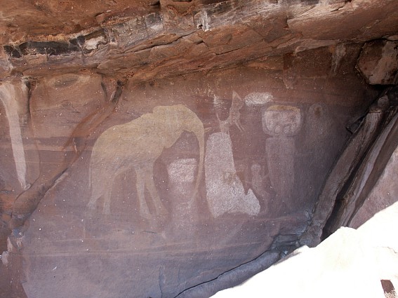
The story of || Khauxa!nas may indeed go far back into Namibia's past. The availability of constant water supplies from the Bak River is likely to have made this place an ideal site for settlement by the country's first inhabitants. Animal husbandry, cultivation of crops, metal working, pottery and pastoral living were typical characteristics of the early Iron Age in Africa. Interesting discoveries of pottery fragments and iron powder, together with rock paintings in the overhanging cliffs above the Bak River, could indicate that both Nama and San lived here, using the place as an early trading centre [1]. The written history of ||Khauxa!nas only begins, however, with the advent of European settlers at the Cape of the Good Hope in the mid-17th century and their expansion into the southern African interior around 1750.
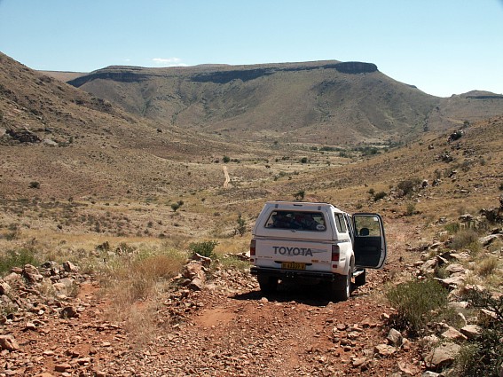
Warmfontein: Gurus River: Karas Region: April 2003
Copyright of Photos: Dr. Klaus Dierks

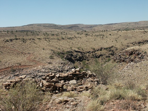
Rockpainting near ||Khauxa!nas: Warmfontein: Gurus River: March
1996
Copyright: Dr. Klaus Dierks


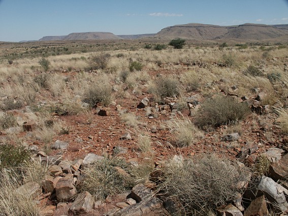
Rockpainting near ||Khauxa!nas: Warmfontein: Gurus River: April
2003
Copyright of Photo: Dr. Klaus Dierks

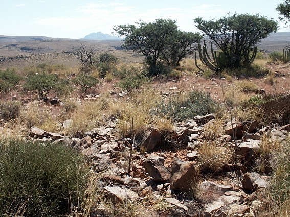
The overhanging cliffs above the Bak River: On the top is the
Mountain Fortress ||Khauxa!nas: View to the East: During the Year of discovery of the
Ruins: 1987
Copyright of Photo: Dr. Klaus Dierks
Among the builders of ||Khauxa!nas were the Orlam Afrikaners (so-called Orlams) who reacted with growing resistance to their systematic dispossession by and subordination to the Cape Colony's white settlers. The Orlams were obliged by the superiority of European technology and weaponry to the northern frontier zone of the Cape where, in the mid-18th century, effective control by the established authority was fairly weak. Resistance by the Orlams is, however, capable of different interpretations, according to ideological standpoint. For "SWAPO of Namibia", the Orlam's history is one of a Namibian freedom struggle against South African colonialism [2]. In contrast, the white farming community of the Calvinia district of northern Cape province see it in terms of the murder of Pieter Pienaar, the farmer [3].
These conflicting standpoints present various difficulties to anyone researching the early history of the Orlams. Archive documents from the 18th century describe them mainly as criminals, vagrants and thieves. The usage of European names and nicknames such as Piet, Klaas, Oude Ram, etc. indicated not only the contempt of the white settlers for the indigenous communities - and the fact that very few tried to learn their languages - but makes the task of the contemporary historian in identifying individual and specific groups even more difficult.
The German missionary Heinrich Vedder maintained that the Orlams were a people of mixed Nama and slave origin, who were also related to the Guriqua or Garigriqua, a Nama group residing in the southern region of the Cape [4]. Unfortunately, Vedder omitted to give his source and the precise origin of the Orlams is still not entirely transparent, although it clearly involves the intermingling of Europeans in their northward expansion from the Cape and the indigenous communities of the interior.
During the 1760s, the first European explorers had already approached the area where ||Khauxa!nas is situated. In August 1760, a certain Jacobus Coetzee reached Rietfontein (Dabegabis), near Warmbad [5]. One year later, in November 1761 Hendrik Hop and his expedition took a route to the east of the Great Karas Mountains, after they had penetrated Great Namaqualand at Ramansdrift on the Oranje River the previous September. Hop followed Coetzee's route from Ramansdrift to Warmbad and on to Dabegabis which he reached on 11 October. From Dabegabis, Hop journeyed to the Draay River (Kainab River) east of the Great Karas Mountains, and from there via Klipkuyl (Klip Fontein or Robber Henrick's Place, the ||Hawoben capital on Narudas 268 ?) and Patensie Hoek (Naos 79) to the Buffels River (Gausob River). On 22 November, Hop reached the farthest point of his journey at Keerom (Gründorn on Brauss 48) on the Chamob River (Löwen River). This was the deepest penetration of the interior so far made by any explorer from the Cape [6].
Patensie Hoek is about 35 km west-north-west from ||Khauxa!nas, although Carel Frederik Brink in his diary of Hop's expedition, made no mention of any Namaqua mountain fortifications. According to Brink they did not get near to the site of ||Khauxa!nas. In 1761, the Orlams had not yet moved into Namibia from the south and if there was a prior settlement in existence it was not mentioned to the European explorers by the local Nama population.
Although only the vague outline of the Orlams' pre-1760 history is known, the possible founder of ||Khauxa!nas was referred to in an official document as early as 1761. The reference is contained in an official complaint by a civil servant employed by the Dutch East India Company of that year. The letter, from Adriaan van Schoor, is addressed to the Governor of the Cape of the Good Hope and concerns the conduct of " Bosjemans Hottentotten Capitein Claas en Afrikaner" [7]. This could be the same person as Klaas Afrikaner, ||Khauxa!nas' probable founder. Incidents such as these, reflecting the impact of European domination in the Cape, led to the previously cited life sentencing of " Oude Ram" and his son "Afrikaner" to Robben Island. The latter's brother Klaas Afrikaner was exonerated and Oude Ram most probably died before the authorities had time to banish him. " Afrikaner Hottentot" was sent to Robben Island on 12 September 1761 and died there on 25 June 1777 [8].
These incidents provide the key to the role played by the Afrikaner clan in the northern Cape frontier zone. Van Schoor's complaints are a clear indication of the refusal by the Afrikaners to submit to the authority of the Cape government and their emergence as leaders of the Nama resistance against European expansion in the last 40 years of the century. "Oude Ram" appears to have been the leader of the clan, with Afrikaner and Klaas his two known sons. After Afrikaner's banishment, Klaas became the Orlam leader, with Jager and Titus his two sons and Jonker Afrikaner his grandson. It was Klaas and his two sons who most probably founded the fortified town of ||Khauxa!nas. Although the precise foundation date is not yet known, it could prove to have been as early as the 1770s, as later evidence will show.

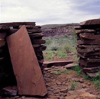
The Ruins of ||Khauxa!nas: View to the
South East: With Protection Wall in the Background: Year of the Discovery of the Ruins:
1987
Copyright of Photo: Dr. Klaus Dierks


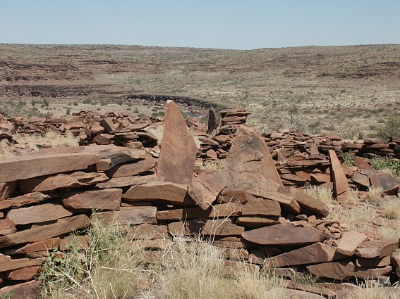
The Ruins of ||Khauxa!nas: View to the
South East: With Protection Wall in the Background: April 2003
Copyright of Photos: Dr. Klaus Dierks


||Khauxa!nas: View from the Top of the Ruins to
the East: With Protection Wall in the Background: January 2004
Copyright of Photos: Dr. Klaus Dierks

||Khauxa!nas: View from the Top of the Ruins to
the West: With the Great Karas Mountains in the Background: April 2003
Copyright of Photo: Dr. Klaus Dierks
By this time the impoverished and rootless Orlams faced two alternatives; either to escape from expanding European influence by migrating into the interior or submitting to the overlordship of the white settlers. The former would involve seeking a livelihood from hunting and raids of other Nama communities, while the latter involved a degree of active collaboration with their European masters. It would seem that the Orlams tried to strike a balance between these two courses of action, and each had its own distinct phase. In the 1770s, they became subject to a Cape settler, Pieter Pienaar, thus inaugurating the "collaboration phase" which lasted until 1796.
It also appears possible that the Orlams were authorised by the Cape government to mount their own attacks on the Nama in the Oranje River area. These expeditions were probably in many instances carried out in collaboration with Pienaar [9]. From 1796 onwards the Orlams entered a " resistance phase" against the Cape settlers, which probably involved the establishment of ||Khauxa!nas during the 1790s, although it may already have been in existence at this time.
It seems most likely that all of the pre-colonial indigenous communities in Namibia went through a similar alternating pattern of resistance and collaboration, with the Orlams being no different in this respect than other groups [10]. The issue of resistance and collaboration in a colonial environment is a difficult one in African history. Terence Ranger came to the following conclusion [11]:
"A historian has indeed a difficult task in deciding whether a specific society should be described as "resistant" or as "collaborative" over any given period of time. Many societies began in one camp and ended in the other. Virtually all African states made some attempt to find a basis on which to collaborate with the Europeans; virtually all of them had some interests or values which they were prepared to defend, if necessary, by hopeless resistance or revolt."
But this dichotomy of resistance and collaboration cannot be applied too rigidly given the fluid conditions prevailing in the open frontier zone of the Oranje River region during the 18th and early 19th centuries. Even after Pienaar's shooting in 1796, the Orlams tried to repair their strained relations with the Cape administration. This is shown in the dispatch of an envoy, Kobus Booy, on a peace mission to Cape Town in 1799 and the Orlam's readiness to help apprehend the murderers of the Wesleyan missionary William Threlfall in 1827 [12].
There are no authentic records of the Orlam's own view of their relationship to the European colonialists. It is conceivable that they viewed the European occupation of the Cape Colony more in terms of an inexplicable natural catastrophe rather than as the reason for a resistance war against colonialism. The actual events of the period need to be seen in their historical context and cannot be interpreted solely in terms of the recent national liberation struggle of the Namibian people. It is also doubtful that the Orlam resistance can be characterised as Robin Hood-style socially redistributive banditry. Although in socio-economic terms the Orlams became, under the impact of European colonialism, dispossessed and detribalised, they retained a superior status compared to other Nama communities in the northern Cape and southern Namibia. Their possession of fire-arms and horses, enabled them to become the most powerful group in Namibia by the mid-19th century. At the end of the 18th century, however, the dichotomy of resistance and collaboration would appear to have been subsumed in an overriding aspiration to retain their independence as a cohesive group [13]. This is not to say, of course, that such a collective aim could not develop the characteristics of an explicit anti-colonial struggle, as demonstrated at the end of the 19th century in the war fought by the Witbooi-Nama against the German colonial power in Namibia.

Map of southern Africa (1790-1830).
It shows the expansion of the Cape Colony; the raiding for cattle; the trading frontier of
the colony; and the expanding African states seeking to control land and trade and to
defend themselves from the Boers, Griqua and other Orlam communities.
Anne Westoby, Longman Namibia
By 1770 the Oranje River region had become already quite well known to Europeans. Pieter de Bruyn, Willem van Wyk and others had reached and crossed the Oranje River as early as 1738 [14]. During 1776-77 three grazing grants were allocated to tenant farmers on the south bank of the river and by the latter 1770s, Pienaar was installed on his tenant farm " Hartenbeestenrivier" at the Oranje River, opposite Harte beestmund in present-day Namibia [15].
An itinerant missionary, Reverend John Campbell of the London Missionary Society, narrated that Pienaar entrusted the care of his livestock to Klaas Afrikaner and his sons Jager and Titus during their migrations to the Oranje River region [16].
Although the Orlam Afrikaners gradually moved northwards, they tried to maintain their supply lines to the Cape trading system because of their need for arms, ammunition and other necessities. This provided a type of "raiding and trading" society which characterised the Orlams throughout their existence. Although the precise date of their arrival in the Oranje River region is not known for certain, by 1779 both they and Pienaar appear to have been established in the area, acting as guides to occasional travellers with their thorough knowledge of the northern frontier locality. We also know that from 8-15 December 1779 Klaas Afrikaner was at Warmbad, which may also contain a clue to the foundation of ||Khauxa!nas. Klaas and Pienaar accompanied William Paterson and Robert Gordon on a journey to the Oranje River region in this year [17].
Paterson mentioned Pienaar and his Nama companions without however referring specifically to the Orlam Afrikaners. On 27 November 1779, however, Gordon referred to "Pinar en zyn volk ... Enigen van Pinars hottentotten waren ziek, door het sterk lopen in de hitte; gaf onse beste schut, Africaander, op zyn versoek wat medicynen. Willende hy met my in het namacqua land mede gaan" (Pinar and his people ... Some of Pinar's hottentots became sick by travelling in the heat; gave our best rifleman, Africaander, on his request some medicines). "Africaander" could well have been Klaas Afrikaner, the Orlam leader at this time. Regarding the period of 8-15 December, Gordon wrote in his diary: " ... vertrok met de twee bastert hottentotten Claas en Piet, ende hottentot Africaander, die met my de rivier (Oranje) op gewees was, de rivier af met vyf dragossen ... Wy kregen aan de ove syde .. grote namacquas van de Caminoekwaas (!Gami-#nun) stam. ... Sy naam is Owbeep en legt digt by het warme bad, dat sy Abeep heten, en de leeuwe rivier (Hom River)" (... left with two mixed-blood Hottentots Class and Piet, one Hottentot Africaander, who have been up the river before, down the river with five pack-oxens ... We met at the other side .. Great-Namaquas of the Caminoekwaas tribe. ... Its name is Owbeep and is closely situated to Warm Bath which they call Abeep at the Lion's River) [18].
Francois le Vaillant who journeyed in the Oranje River area during 1783 mentioned Pienaar but not the Orlams [19].
Through having Pienaar's cattle entrusted to them the Orlams gained a measure of freedom, but remained dependent on him for access to weapons and ammunition. In the following years the relationship between the Orlams and Pienaar developed into a virtual partnership with both parties dependent on the other. Their activities between 1783 and 1789 cannot be firmly documented but it would certainly appear that they were still moving about in the vicinity of the Oranje River as around 1790 rumours were in circulation that the Cape administration was considering imposing military service on the Nama [20].
During the 1790s the Oranje River region became a refuge for various impoverished and uprooted Nama and Orlam communities, because in these sparsely populated districts they could remain free from direct control by the white settlers and colonial authorities. With the arrival of additional Nama groups armed with guns in the early 1790s, resistance against the Cape settlers began to grow.
By 1792 already it appears that Pienaar had become determined to take action against this increasing resistance and intensified attacks on white settlers. At this stage the Orlams were still in alliance with Pienaar, and indeed helped him to conduct several commando raids on other Nama groups. It is not immediately clear why Klaas Afrikaner should have helped to protect the settlers. As cattle owners the Orlams probably also suffered from raids by other Nama groups but more crucially, participation in the raids organised by Pienaar provided them with the opportunity of obtaining weapons and ammunition. This alternating pattern of trading and raiding also gave them a greater degree of independence from Pienaar, as well as gaining them the trust of the Cape government. This is demonstrated by the involvement of the Orlams in the infamous " Bushman hunts" at this period, while in 1792 it is recorded that they killed 113 Bushmen (now known as San) near the Sak River in the Cape Colony interior [21].
In 1793, Klaas Afrikaner and his followers conducted a commando campaign against the "Bastaard Hottentotten", the descendants of Nama and slaves who had migrated northwards. During the course of this campaign, which was undertaken on behalf of the Cape government, the Orlams moved deep into Namibia. On their return to the Oranje River they were caught up in a skirmish with Guilliam Visagie [22], the first white settler in Namibia itself, who had established himself in #Nu#goaes (Swartmodder, later Keetmanshoop) [23]. Visagie, his son and some of his Baster retainers, launched an attack on Afrikaner, who lost four of his men and was forced to retreat. At this time the Orlams were still on good terms with the Cape authorities, and a "staff of office" which had been issued to Afrikaner, was lost during this battle [24].
Further details of Afrikaner's campaign in Namibia are not known, and although it is conceivable that they visited the area of ||Khauxa!nas there would have been no need for a refuge given their good relations with the government. It remains to be established whether Knudsen's "Titus' Steingrotte" [25], a possible reference to one of Afrikaner's sons (Titus Afrikaner), could also be applicable to ||Khauxa!nas but it can be established that this locality refers to a place near #Nu#goaes.
From about 1793 onwards, the relations between the Orlams and Pienaar underwent a change. By their activities in the frontier zone between the Cape Colony and Great Namaqualand the Orlams demonstrated their increasing prominence as an autonomous force. This in part was due to their independent acquisition of weapon supplies as a result of the commando raids they carried out. The events which led up to the shooting of Pienaar have not been recorded, however. Ridsdale [26] gave the following account of the incident: "After shooting of the Dutch Boer, Pinnar, to whom old Afrikaner (Klaas) and his clan were at hat time subject, and by whom they were oppressed beyond all endurance, Afrikaner and his people fled to this place" (Schans Vlakte).
Ridsdale was surely influenced in his account by Robert Moffat, the missionary who later came to know Jager Afrikaner well, and whose own description of the incident was based on the events narrated to him by Jager [27]. Campbell suggested that the affair was provoked by Pienaar's improper conduct towards the wives of the Orlams during the latters' absence on commando raids. Whatever the precise reasons for the Orlams' shooting of Pienaar, his wife and one of his daughters on their " Groot Toorn" farm in the Hantam district in March 1796, the Orlams' refusal to obey Pienaar's order to conduct another commando raid against other Nama groups, is likely to have played a major part [28].
However, the explanation that Pienaar's murder was due to a breakdown in social relations rather than a deliberate act of resistance cannot be ruled out as the Orlams subsequently sought to mend their fences with the Cape government. The cessation of their provision of labour in a colonial relationship with the Cape settler community did not totally alter their established way of life. But after the Pienaar incident, legal trading was no longer possible for them, cutting their ties with the Cape colonial society and ending the successful raider-trader combination [29].
Following the attack on the Pienaars, the Orlams traversed the Oranje River and settled around Blydeverwacht in Namibia [30]. It must have been at this time, between 1796 and the turn of the century, that Klaas Afrikaner and his followers established ||Khauxa!nas to the east of the Great Karas Mountains as a hidden retreat and "impregnable fortification" against possible attempts at pursuit by the Cape authorities, although the only primary historical source to support this is Ridsdale [31]:
"Here they resolved upon making a stand against the commandoes sent in pursuit of them by the Colonial Government. Within this entrenchment, at the top of the mountain, they built their houses, had kraals for their calves, and in fact everything necessary to a Namaqua village, and considered themselves able to defy all their enemies. They seemed scarcely able to conceive of a valour that would proceed in the face of their bullets, scale their fort, bound over its walls, drive them over the fearful precipice on the opposite side, and plunge them into the abyss of black waters beneath. The opportunity of defending themselves in their impregnable fortification, however, never occurred, as the commandoes of Boers from the Colony pursued them no farther than Nisbett Bath."
After the Orlams' escape from the Cape, several official commando expeditions were sent after them, but none of them succeeded. A first commando unit was sent out soon after their retreat to the Oranje River, and concentrated in searching along the Sak River without success. A second expedition under the leadership of the Baster brothers Nicholas and Barend Barends, which was equipped with weapons by the settlers, also failed to accomplish its objective [32]. On 17 May 1799 a third abortive expedition was sent out against the Orlams, who retaliated by attacking white settlers in the Cape [33]. Following the raid, the Orlams returned to their hiding places north of the Oranje with two waggons, 3,700 sheep and goats, 446 head of cattle, eight horses and two guns [34]. A fourth unsuccessful commando search, part of the Truter/Somerville expedition of 1802, led only to the capture of some livestock [35]. The fifth and last expedition may have been undertaken in 1811, although the circumstances are not clear. It seems that Landdrost van de Graaf suggested sending a force of well-armed Basters against the Orlams because he did not want to risk a white unit in Namibia [36].
These Orlam successes and the rumours that all Nama in the Cape were to be counted in a census so they could be taxed, resulted in more groups joining them. Their increased power enabled the Orlams to carry out regular raids for cattle and weapons against the white settlers of the Oranje frontier zone and it would have been about this time that century that Klaas Afrikaner handed over the leadership to Jager Afrikaner, also known as |Hom|aramab.
Shortly after 1800, Pienaar's former associates, who had helped defend the Cape Colony's northern frontier for the white settlers, themselves began raiding the interior. As a result of the expansion of settler influence, the Orlam Afrikaners had lost their traditional means of existence in the Cape and had begun experiencing a process of large-scale social disintegration, not only as a result of European pressures but also due to the activities of other Nama and Orlam groups in the northern Cape [37].
While the history of the Orlam Afrikaners had at least been partially documented in the Cape, it ceased to be recorded altogether following their arrival in Namibia. Not a single reference to ||Khauxa!nas is to be found in the records of the London Missionary Society [38].
From 1805, when the LMS started its work in southern Namibia, the Orlams gradually developed a loose relationship with the missionaries, later to be disrupted by a clash of economic interests which resulted in the Warmbad raid of 1811. It is unlikely that the brothers Abraham and Christian Albrecht, who were stationed at the Warmbad mission from 1805, ever went as far north as the Bak River and ||Khauxa!nas. The same is likely to be true for LMS missionary Johann Seidenfaden, who worked for some time at the Heirachabis mission, north-east of Warmbad. The history of ||Khauxa!nas will therefore to a certain extent remain a mystery, at least until further evidence is unearthed.

The old "Pastorie" of Warmbad which is
built on the Foundations of the House which was established by the London Missionary
Society Brothers Abraham and Christian Albrecht in 1805
Copyright of Photo: Dr. Klaus Dierks
It is known, nevertheless, that Jager Afrikaner was baptised as Christian Afrikaner by the LMS missionary Johann Leonhard Ebner in 1815 [39]. This took place despite the fact that the same Jager had only a few years earlier razed the Warmbad mission of the brothers Albrecht to the ground [40].
Whether ||Khauxa!nas was the starting point for this raid will probably never be known. The reasons for the raid itself are, however, known and had clear economic motives rather than being a random act of violence. Jager Afrikaner believed, rightly as the evidence shows, that Johann Seidenfaden had tried to trick him in respect of the ivory trade between the Orlams and the Cape commercial centres. Seidenfaden acted as middleman in this trade as it was impossible for Jager, as an outlaw, to trade directly with the government. He misused the position to his own advantage in a deal where the considerable amount of 4000 Rijksdaler (Rix dollars) was at stake. This provoked Jager into retaliation, raiding first the LMS mission at Pella in the Cape - which was Seidenfaden's station after he had abandoned Heirachabis - and then Warmbad [41].
In 1819 Jager (Christian) Afrikaner accompanied Robert Moffat, who took over as missionary from Ebner, to Cape Town, where he received an ox-wagon from the governor, Lord Charles Somerset [42]. This was in effect a form of peace treaty between the Orlams and the colonial government so that after 1819 there was no longer any need for the establishment of a fortified retreat such as ||Khauxa!nas. It can thus be postulated that the most likely date for the building of ||Khauxa!nas lies between 1796 and 1798, or somewhat earlier, while its function as a secret refuge against the threat from the south would have ended by 1819. Jager Afrikaner died in 1823 in Blydeverwacht and by this time the Orlams had left the Namibian south and most probably ||Khauxa!nas also, for good. The group split up in that year, when four of Jager's sons under the leadership of Jonker Afrikaner, moved north and established themselves in the border region between Great Namaqualand and Damaraland (not the present entity), with the aim of further reinforcing their control over the other Nama communities of Namibia [43].
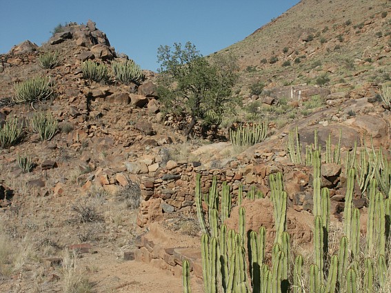
With the departure of the Orlam Afrikaners in the 1820s, ||Khauxa!nas entered a new chapter in its history. Later, during the early 1840s, Jonker Afrikaner founded Windhoek, which could be seen as a successor to ||Khauxa!nas. From this point onwards the Orlams forged the inception of a unitary Namibian state at Windhoek, which was far to exceed the significance ||Khauxa!nas could ever have had for them. But the settlement provided the means for the Orlams, during the time they were there, to successfully resist white settler encroachment and maintain their autonomy from the Cape government. By the 1840s, however, it was no longer an Orlam settlement, but existed as a ||Hawoben village until the beginning of German colonial rule during the 1880s.
Perhaps there is a need here to make clearer the relations between the Orlam Afrikaners, other Nama groups, and the formers' technological advantages. Lawrence Green wrote the following useful summary [44]: "According to Hottentot (Nama) tradition they came from the north-east over the high plateau of Africa, until they reached the "great waters" of the South Atlantic. Some tribes remained in SWA (Namibia), others migrated all the way to the Cape. They brought long-horned cattle with them and also fat-tailed sheep. Milk is their main food. They possess the art of smelting iron but were never painters. ... Two groups of Hottentots are found in SWA - the pure and the primitive (!) Nama tribes which settled there about six centuries ago during the migration and the so-called Orlams who left these tribes behind and went on far to the south of the Oranje River. They returned during the 18th and early 19th century as a result of the pressure of white settlement. "Orlams" appears to be a Cape-Malay word meaning "foreigners" or "intelligent". When they returned (to Namibia) the Orlams had learnt Cape Dutch and owned horses and rifles. Most had come under missionary influence and a few were educated men of great ability. The old Nama tribes included the Bondelswarts (Warmbad), the Red Nation of !Hoaxa!nâs, the Veldschoendragers (Kalahari) and Topnaars of the north. The most powerful Orlams were the Afrikaners and Witboois. War after war with the Namas established the Orlams as rulers with Jager Afrikaner and his son Jonker as great and ruthless rulers. ... Jager Afrikaner fought a war for the Cape Government against the Bushmen towards the end of the 18th century. He then became a raider, using an island in the Oranje River as his base and terrorised the northern border. The Albrecht brothers, pioneer missionaries, had to ride for their lives from Warmbad in 1811 while Jonker also raided Cape districts to Stellenbosch. The missionary Reverend Robert Moffat reopened the Warmbad mission in 1818 and set about converting Afrikaner. Jager's son Jonker then crossed the Oranje, conquered the Nama tribes and by mid-century was ruling at Windhoek."
THE MISSIONARY PERIOD (||HAWOBEN)
Whether || Khauxa!nas remained a secret refuge for the Nama communities of southern Namibia after the 1820s cannot yet be determined. From the accounts of Ridsdale and Bailie it seems clear, nevertheless, that the place was known to the Wesleyan missionaries. Although there is no reference to the site in the records of the German colonial administration, thanks to Ridsdale's observations, we know that after the departure of the Orlams during the 1820s or later, one of the Namibian Nama groups, the Veldschoendragers, moved to ||Khauxa!nas, which they called Schans Vlakte. The Nama name for the Veldschoendragers is ||Hawoben which as in the case of the Dutch appellation refers to a kind of sandal made and worn by them. This term came into use around 1800 [45]. Hendrik Jacob Wikar (1779) and François Le Vaillant (1796) mentioned the ||Hawoben in the account of their journeys. From 1837, the leader of the Veldschoendragers was !Nanib gaib #Arisemab, also known by his European name of Hendrik Henricks. !Nanib was the son of #Ariseb (Kannamab) and !Nanis [46], described as "a stately woman" and the only woman, indeed, mentioned in the entire recorded history of ||Khauxa!nas [47].
James Edward Alexander referred to both !Nanib, whom he named "Robber Henrick" and !Nanis whom he called a "sturdy old hag and limb of Satan", when he visited a location near " Robber Henrick's Place" early in 1837. The hypothesis that this site is identical with the impressive hilltop stone ruins to be seen today on the farm Narudas 268 requires further archaeological verification. Alexander never actually reached Narudas or "Robber Henrick's Place" itself, proceeding only as far as Kama Kams ("Green River") on the farm Groen Rivier 265, several kilometres from the Narudas ruins. He described !Nanib gaib #Arisemab and his mother !Nanis in rather deleterious terms, in contrast to Ridsdale's account of ten years' later.
Alexander writes that "ascending a hill we off-saddled on the other side, in a narrow valley, near some more huts, at a place called Kama Kams, about fifty miles from where I had left the waggon (Kanus 94, west of present-day Karasburg), and only two from the place of the robber Henrick" [48].

Robber Henrick's Place (Narudas) or Klip Fontein south-west of
||Khauxa!nas, possibly Marengo's Camp during February/March 1905 (Photo taken in March
1988)
Copyright of Photo: Dr. Klaus Dierks

Narudas Ruins: View to the East: This Part was used by Abraham
Morris during the March 1905 Battle of Narudas
Copyright of Photo: Dr. Klaus Dierks

The Narudas Ruins: Details of the Walls: View to the East
Copyright of Photo: Dr. Klaus Dierks

View onto the Narudas Fortress in a southerly Direction
Copyright of Photo: Dr. Klaus Dierks

The Narudas Ruins: View to the Southwest into the Great Karas
Mountains
Copyright of Photo: Dr. Klaus Dierks


The Narudas Ruins: View to the North, to the Narudas Peak: April
2003
Copyright of Photos: Dr. Klaus Dierks


Access Climb to the Narudas Ruins from the North: April 2003
Copyright of Photos: Dr. Klaus Dierks


View from the Narudas Ruins to the South to the highest Point of
the Ruins: April 2003
Copyright of Photos: Dr. Klaus Dierks
This description and the distances given strongly suggest that the ruins at Narudas are the same site referred to by Alexander. On the spot investigations during March 1988 support the thesis that Alexander's capital settlement of the Veldschoendragers is synonym with Ridsdale's " Klip Fontein" (and the same as Brink's " Klipkuyl" of 1761?) [49].

The Narudas ruins: view to the west into the Great Karas
Mountains: March 1988
Copyright of Photo: Dr. Klaus Dierks


View from the Narudas Ruins to the Northwest into the Narudas Gorge: April 2003
Copyright of Photos: Dr. Klaus Dierks
In 1846 Ridsdale described a journey by him from Stof Kral, "thirty-seven miles further to the north-east (from the missionary station Warmbad)" to "Klip Fontein, the present residence of the chief of the Veldschoen Draagers .. About three hours after resuming our journey, whilst passing along the bottom of a narrow, luxuriantly grassy valley, though so strewn all over with loose stones as to make it difficult for our horses to walk, ... the mother of Hendrik Hendriks, the chief of the Veldschoen Draagers, made her appearance". Ridsdale continues to write that "after travelling two and half hours more, we came in sight of the small village in which the chief and two hundred of his people had pitched their huts; as soon as we were seen to descend the hillside sloping down towards the village, ... which was situated straggling in a long narrow valley" [50].
View from the Narudas Ruins to the East in direction of
||Khauxa!nas: April 2003
Copyright of Photo: Dr. Klaus Dierks

The highest Point of the Narudas Ruins: April 2003
Copyright of Photo: Dr. Klaus Dierks
Taking into consideration all these historic references and the existence of the Narudas ruins - the origin of which remains obscure - it can be concluded that these stone remains are the forgotten " Robber Henrick's Place" ("Klip Fontein"), the capital village of the ||Hawoben until they moved it to Schans Vlakte. The available historical evidence indicates that Klip Fontein lost its function sometimes between 1844 and 1846 because as from 1847 Schans Vlakte was described by both Bailie and Ridsdale as the seat of the ||Hawoben chief. A further conclusion would be that, as with ||Khauxa!nas, Ridsdale and subsequently Bailie were the only Europeans allowed to visit the main ||Hawoben settlement, because Alexander had not been able to get to "Robber Henrick's Place" in January 1837. In consequence, the idea that Klip Fontein was identical with Schans Vlakte as suggested earlier, can now be ruled out [51].
The Narudas site can be described as follows:
The Narudas site lies at the mouth of the Narudas Valley dominated by a natural parallel stone ridge on a cone-shaped mountain that runs roughly from north to south. This mountain lies on the northern side of the valley. On the southern side there is another mountain ridge which is completely integrated into the ruins of the Narudas site. The site can be broken up into a number of separate components. Firstly there is a fortress on the ridge, running roughly north to south, consisting of parallel walls up to 2,5 metres in height with a number of buildings and structures within it. Secondly there is an extensive settlement of approximately twenty five stone hut circles on a sloping plateau to the immediate west of the fortress. This site is dominated by a large stone kraal of approximately 20 metres in diameter. Thirdly below the eastern walls of the fortress there is a flat plateau tending towards the Narudas River. This site is dominated by some square buildings which are probably the remains by some buildings which were constructed by the Germans after 1905.Besides Bailie, the only reliable witness to the presence of the ||Hawoben at Schans Vlakte from 1847 is Ridsdale. His account of 5 April 1847 of the ||Hawoben of Schans Vlakte provides a fair description of this early Nama group Namibian civilisation [52]:
"This visit (to Schans Vlakte) has given me great and unmingled satisfaction, and I could not help contrasting the present state of the Veldschoen Draagers with that in which I found them in 1844. Then there were neither candidates nor members (of the Christian Church); now we have fifty-eight regularly meeting in class. Then they had no place of public worship, and no schools; now they have a large stone chapel in course of erection, and a hundred and fifty children in the Sunday and week-day schools. We have also twelve Sunday- school teachers selected amongst themselves. Then they were only occasionally visited by one of the nearest native teachers, though residing at considerable distance, who at such time held service in the open air; now they have a native assistant living in their midst, and enjoy stated instruction. They were at that time almost destitute of any decent clothing, the mother (!Nanis) of the chief (!Nanib gaib #Arisemab or Hendrik Henricks) herself being perfectly naked, with the exception of a small strip of skin round the loins; but since my first visit traders have found their way thither, and now a large number are clothed in articles of English manufacture (sic!), and the Sunday congregations nearly equal in respectability of appearance the congregations on the principal station (Warmbad). Then they had neither waggon-roads nor waggon, but now, considering the character of the country, they have made a tolerable road, and are in possession of eight waggon. .."
Ridsdale's account establishes that the ||Hawoben leader !Nanib, and his mother !Nanis, are synonymous with the "Robber Henricks and his mother" described by Alexander in 1837. This report also demonstrates that the missionaries not only interfered in Namibian politics but also tried to influence all aspects of Namibian life, with trade, especially in European goods, strongly promoted. The missionaries believed that Namibians could only become true Christians if they adopted European names, clothes and a European way of life in general.
During the Wesleyan missionary period, from the 1820s until the 1860s, Schans Vlakte formed part of the " Nisbett Bath Circuit". North of Nisbett Bath (Warmbad), at a distance of 70 to 80 miles (112 to 128 km) was the settlement of Amas under the care of James Witbooi. Some 40 miles (64 km) to the north-east of Warmbad, was located Nieuwe Fontein (Nuwefontein 54) under the leadership of James Gagup, while 40 miles in a north-easterly direction from there a group of nomadic Nama lived in the vicinity of the Bak River, along with a teacher/ preacher Elias Rolfe. In 1846 another teacher/ preacher, Frederick Buys, started work among the Veldschoendragers of Schans Vlakte at Ridsdale's request. Buys remained at Schans Vlakte until the ||Hawoben moved to the north. When Ridsdale left Warmbad to return to Great Britain, John A. Bailie took over from him in 1847 [53].
In September 1848 Bailie recorded that the ||Hawoben chief and his people had refused to leave the Schans Vlakte mountain to join a service [54]. They changed their minds only after Bailie threatened to leave the place and never return again to serve them as a missionary. From this it may be deduced that the ||Hawoben at ||Khauxa!nas had begun to disobey the instructions of European missionaries. The reasons for this act of resistance are not fully clear as we only have Bailie's account of the event. Bailie added the following comment about Schans Vlakte in his diary:
"In this country are to be seen, here and there, the old "Schansen" or Namaqua Forts, and some curious tombs raised in memory of some of their bravest warriors. These tombs are formed of choice stones from four to six feet long, placed perpendicularly with one end in the ground, and within a few inches of each other; and the bones, horns and hooves of eight or ten oxen thrown inside-which oxen were usually chosen of the same colour, and slaughtered on the spot, and the flesh eaten by those who were assembled to council the deceased."

Tombstone on the eastern side of the ||Khauxa!nas
Mountain Fortress
Copyright of Photo: Dr. Klaus Dierks

Ruins of the alleged ||Hawoben Church at Schans Vlakte, west of
the ||Khauxa!nas Mountain
Copyright of Photo: Dr. Klaus Dierks
Mears records in addition that Bailie's missionary endeavours were adversely affected by the steady northwards drift of the ||Hawoben [55]. Bailie's diary clearly shows that this migration was caused by the severe drought conditions prevailing at the end of the 1840s, followed by a rinderpest epidemic among their cattle at the beginning of the 1850s [56]. The impoverished condition of the Namibian south led to the withdrawal of the Wesleyan Missionary Society. In 1867 the Rhenish Missionary Society from Germany took over from the Wesleyans, but from this time onwards no further reference to ||Khauxa!nas and its population can be traced [57].

The Church of the Rhenish Missionary Society at Warmbad,
inaugurated by missionary Weber in 1877
In 1857 !Nanib gaib #Arisemab became an ally of the Orlam Afrikaners and during the following decade achieved fame as a fearless and skilled warrior. By this time it can be assumed that many ||Hawoben had moved north to join Jonker Afrikaner at Windhoek [58]. !Nanib died in 1865 without having a male heir and his brother !Nanib #Karib #Arisemab, who had been baptised Karl Hendrik (Ses) took over as ||Hawoben leader. The history of ||Khauxa!nas and its ||Hawoben inhabitants between the later 1840s and 1886 is not recorded. We can be fairly sure, however, that ||Khauxa!nas lost its importance to the ||Hawoben after the death of the older !Nanib when they moved further north to the Koës area [59].
However, it is on record that a subsequent ||Hawoben leader, Karl Hendrik, sold a place known as " Kora-Orap" to one Alfred Fryer on 8 June 1886. ||Khauxa!nas formed part of the land belonging to this huge farm, which extended to 94,000 hectares. In the "Kennis van Verkooping" (notice of sale) it was stated that the size of "Kora Orap onder die Berg" must be measured from a zero co-ordinate "twee en half uur te paard in alle kante" (two and a half hours by horse in all directions). The purchase price of Kora Orap was 325 pounds sterling and it was one of the first farms in south-eastern Namibia to be surveyed. This was done by the land surveyor, von Quitzow on whose survey map the location "Schansen" or " Schanssen" is identified east of the confluence of the Gurus and Bak rivers, at the same site as Ridsdale's Schans Vlakte [60]. This is further evidence that these "Schansen" (fortresses or bulwarks) existed in the pre-colonial era, although by this time ||Khauxa!nas was most likely no longer inhabited by the ||Hawoben or at least no longer held its formerly important status. Why Kora Orap was sold to Alfred Fryer is not known. One possible explanation is that according to von Quitzow's map Kora Orap was situated between the ||Hawoben areas in the north and those of the !Gami-#nun (Bondelswarts) to the south. The farm may have been seen by the ||Hawoben as a kind of buffer zone and for that reason was sold. Further light on this could possibly be cast through oral research among the local communities.
In 1886, when Fryer purchased Kora Orap, the Germans had proclaimed their occupation of Namibia but had yet to establish effective rule. Henceforward no further information on the involvement of the Nama with ||Khauxa!nas or any separate function of the settlement is recorded. The last role of ||Khauxa!nas was as the final hiding place for Jakob Marengo. Thereafter it sank into obscurity as part of the European-owned commercial farms east of the Great Karas Mountains.
A rather obscure account is provided by one Gilarmi Antonio Farini who travelled to the eastern part of Namibia and western part of Botswana in 1885. Farini claimed to have discovered strange and ancient ruins in the sands of the Kalahari. Many were from the outset skeptical about Farini's claims. This " Lost City of the Kalahari" was, according to Farini's map, located in the modern-day Aminuis area of Namibia or just east of it, across the border in Botswana. Despite inducting a number of systematic searches conducted by expeditions mounted after the Second World War, the Farini ruins have never been located. One suggestion offered by way of explanation was that a natural dolerite formation with some similarities to a ruined city could have been Farini's "Lost City" [61]. Many questions about Farini's "discovery" remain to be answered. Why did he make no use of his camera to provide visual proof of his claims? His description of the ruins, whatever and wherever they may be, is rather puzzling as they appear from his account to have a remarkable similarity to ||Khauxa!nas. Could it be that Farini had heard about the secret settlement of ||Khauxa!nas and used the oral evidence for his account without ever having been there [62]?
Further information about the ||Khauxa!nas area from the 1890s onwards can be found in the Kora Orap farm records. Kora Orap later became subdivided into several smaller farms, with ||Khauxa!nas located on the present-day farms Schanzen 281 and Gugunas 301. During the early 1890s, Alfred Fryer was forced to take legal action against " Scotty Smith" a notorious adventurer and arms smuggler of the Kalahari region, to defend his property title to Kora Orap. The German magistrate's court at Warmbad ruled in Fryer's favour on 19 March 1893 [63].
No further information about ||Khauxa!nas is to be found until the outbreak of the resistance war by the Nama in 1903- 04. The region east of the Great Karas Mountains was, because of its in access seldom visited by official or independent travellers. Even the Governor of German South West Africa, Curt von Francois, who was renowned for his frequent inspection journeys throughout the colony, never penetrated the region. One exception was Th. Rehbock, a German civil engineer, who visited Fryer's Kais farm in 1897 because the latter had constructed one of the first dams in the country. But in his writings Rehbock made no reference to an old fortified Nama settlement [64]. Then in 1903 Jakob Marengo appeared on the scene and ||Khauxa!nas, for the last time, played a significant role in the history of Namibia.

Robber Henrick's Place (Narudas) south-west of ||Khauxa!nas,
possibly Marengo's camp during February 1905 (Photo taken during March 1988)
Copyright of Photo: Dr. Klaus Dierks
THE ACTIVE PERIOD (THE !GAMI-#NUN AND JAKOB MARENGO)
The final period in ||Khauxa!nas' history during the colonial era centres on the !Gami-#nun or Bondelswarts people, of whom one of their greatest sons was Jakob Marengo. A definitive judgement of this leading personality on the Namibian side during the 1903-09 resistance war has still to be made. Here it can be observed that Marengo is either not mentioned at all in Namibia's meagre historiography, or only of banditry, cattle-rustling and "terrorist activities" [65].
Similarly, we need to rescue Marengo's people, the Bondelswarts, from their categorisation as an "obscure Hottentotten tribe in SWA" [66]. The Nama term "!Gami-#nun" means "the people of the black bundle or Bondelsitter" [67]. During most of the 19th century the !Gami-#nun kept their distance from the conflicts taking place elsewhere in Namaqualand and Damaraland [68]. They were able to do so due to an advantageous geographical position close to the Cape Colony and through their role as border police, paid by the Cape government.
At present, we can do little more than speculate as to the role ||Khauxa!nas may have played in the 1903-9 war and its importance to Jakob Marengo's guerilla campaigns. Its function during this period is not mentioned in any known primary historical sources. But in contrast to Marengo's depiction in present-day historical works, it is remarkable how contemporary sources viewed this great Namibian leader. After Marengo's incarceration in Cape Town's Tokai prison in May 1906, even the German General Staff paid him the following compliment [69]:
"The elimination of Morenga from the ranks of the enemies of the Germans was a significant success of German arms. Even though this event could not have the same effect as the death of Hendrik Witbooi because of the rapidly sinking reputation of Morenga among the Bondels, yet this Herero-bastard stood out above all the other Hottentot leaders because of his personal stature, his determination, his will to act, his courage. He can be seen as the intellectual source of most of the Hottentot attacks, which were executed with such great skill. His internment was a blow to the cause of the Hottentots that could not be repaired."
||Khauxa!nas' part in the resistance wars of the Namibian south can be determined only by circumstantial evidence, with the support of a few historical sources. The beginning of Nama resistance to colonial annexation by Germany was the famous letter written by Hendrik Witbooi to Samuel Maharero, leader of the Herero people, on 30 May 1890, which concluded with the sentence: "You will one day regret bitterly that you surrendered your land and sovereignty to the white people" [70]. This letter provided the basis for the peace treaty of 1892 between the Nama and Herero. It was a landmark in Namibian history because it placed the indigenous people and the German colonial power on opposing sides for the first time [71].
During the Bondelswart uprising of October 1903 ||Khauxa!nas probably exercised its traditional function as a refuge for resistance fighters against the colonial power. Jakob Marengo is mentioned in this respect for the first time in the German records, although there is no direct confirmation that he directly took part in the Bondelswart campaign in the official reports of the German General Staff [72]. Other sources reveal, however, that Marengo was one of the leaders of this uprising, which preceded the Great Nama War of 1904. The !Gami-#nun resistance struggle took the form of a number of small, isolated skirmishes in which the German Schutztruppe (protection force) did not play an especially glorious role [73].

The Grave of the Bondelswart Chief, Jan Abraham
Christian (Tôasib: |Nanseb Kaib #Naoxamab), in Warmbad (Old Location) who fell against
the Germans (Walter Jobst) on 25.10.1903 and initiated the German-Namibian War,
1903-1909
Copyright of Photo: Dr. Klaus Dierks


The Cemetery in Warmbad with many German War Graves of the
various Battles and Skirmishes between 1903 and 1905: Walter Jobst' Grave is the big Tomb
Stone in the Background (1st Photo)
Copyright of Photo: Dr. Klaus Dierks

Remains of the German Fort at Warmbad which has been 1913
restored as the present police station: It served as the headquarters of Lieutenant Walter
Jobst at the time of his death in October 1903, and was blockaded unsuccessfully by
Marengo's forces in 1903 and 1904
Copyright of Photo: Dr. Klaus Dierks

By igniting the final spark that precipitated the greater war waged by the Nama from 1904, Jakob Marengo fulfilled his historical function as a great leader in the national resistance struggle. In 1907, Bruno von Schuckmann, then Governor of German South-West Africa, recorded: " Morenga's appearance was like an electric shock, causing great excitement among the natives, all the way to the north. To restore calm it was necessary to stop sending soldiers home so as not to leave the north entirely unprotected" [74].
Bishop John Marie Simon of the Roman Catholic Congregation of the Oblates of St.Francis de Sales was the priest at the Pella Catholic mission, situated just south of the Oranje River in the Cape Colony. He recorded that Marengo had a Herero father and a !Gami-#nun mother. He was probably born at Vaalgras, some 60 km east of Tses, and a Nama-speaking Herero community still lives at Koichas, in the vicinity of Vaalgras [75]. Marengo was brought up by a man known as Carolus Damara, who later lived in Simon's parish of Pella after he and his whole family had been converted to Catholicism [76].
More important perhaps is the fact that Marengo had worked at the O'okiep mine in the northern Cape as a labourer-clerk shortly before the outbreak of the Bondelswarts uprising in October 1903. He had a mission school education and probably had also lived in Germany for some time. During his period as resistance leader he attracted a large following of !Gami-#nun and other Nama [77]. Marengo's followers included Herero as well, unusual for the time, and a pointer to the evolution of the national resistance movement towards the goal of a "supra-tribal" society in a future independent and united Namibia.
The chronology of events immediately prior to and during the Bondelswarts uprising indicates that ||Khauxa!nas could have served as Marengo's secret retreat. From this inaccessible and impregnable mountain fortress he may have launched his surprise attacks against the Schutztruppe. During the many skirmishes of 1904 and 1905 Marengo repeatedly disappeared without trace, successfully shaking off his pursuers somewhere in the area of the present-day farm Gugunas 301 (||Khauxa!nas). The following circumstantial evidence supports this hypothesis.
Following the Kalkfontein peace treaty of January 1904 between the !Gami-#nun and the Germans which brought to an end the Bondelswarts uprising, Marengo was outlawed by the colonial authorities. He escaped initially to the inaccessible Karas Mountains and later to British territory [78]. But in July 1904 he returned to Namibia and together with 63 of his fighters, entrenched himself in a fortified camp at the Schambockberg on Kais (now the farm Tränental 299) [79]. German sources contain many references to this fortified camp without specifying its locality and characteristics. A letter of 5 September 1904 from the Keetmanshoop "Bezirksamtmann" (Regional Commissioner) Schmidt, to Governor Theodor Leutwein in Windhoek stated, however, that the camp must be situated in a more westerly direction, on Kouchanas Farm - i.e. Gugunas 301/ ||Khauxa!nas [80].
Therefore this fortified camp is in all probability one and the same as ||Khauxa!nas, although we know that Marengo used various camps in the vicinity of the Great Karas Mountains. In his fragmented diaries, Marengo himself referred to "Kactchanas" and by underlining the name indicated the importance he attached to this base [81].

Extract of Marengo's Diary - note the Heading and Date at the Top


On a Search Trail for new Pre-colonial Ruins in the Great Karas
Mountains: From Narudas via Witkrans, Garies to Sandmund: Karas Region: April 2003
Copyright of Photos: Dr. Klaus Dierks

Pre-colonial Ruins in the Great Karas Mountains: Garies Possible
Watch Tower over a Waterhole in a Riverbed: In the Background: Garies Hill with numerous
Ruins: Karas Region: April 2003
Copyright of Photo: Dr. Klaus Dierks
Pre-colonial Ruins in the Great Karas Mountains: Garies Possible
Watch Tower over a Waterhole in a Riverbed: Karas Region: April 2003
Copyright of Photo: Dr. Klaus Dierks

Pre-colonial Ruins in the Great Karas Mountains: Sandmund: In
the Background: Narudas Poort: Karas Region: April 2003
Copyright of Photo: Dr. Klaus Dierks
Pre-colonial Ruins in the Great Karas Mountains: Sandmund: View
to the South: Karas Region: April 2003
Copyright of Photo: Dr. Klaus Dierks


Precolonial Nama Ruins: Top of the Great Karas Mountains: View
to the South: Garies Hill: Possible Secret Fortress built by Jakob Marengo: April
2003
Copyright of Photo: Dr. Klaus Dierks

Precolonial Nama Ruins: Top of the Great Karas Mountains: Garies
Hill: View to the Southeast: To the Narudas Poort: Garies: April 2003
Copyright of Photo: Dr. Klaus Dierks
Precolonial Nama Ruins: Top of the Great Karas Mountains: Garies
Hill: View to the West: With Lord Hill (Schroffenstein: Highest Peak in the Great Karas
Mountains) in the Background: Garies: April 2003
Copyright of Photos: Dr. Klaus Dierks
In order to conduct surveillance of Marengo's activities, Lieutenant Nikolai von Stempel and a company of 32 men arrived in early August 1904 at Samahaling, near the eastern border of the German " Schutzgebiet" (protectorate). In the meantime, Marengo had disarmed many of the farmers in the area without causing them physical harm [82]. His magnanimity in showing mercy to his enemies and sparing their lives in many cases, contrasted with the conduct of the German side [83]. Even Marengo's opponents acknowledged his humanness in contrast to the Germans, who often executed their prisoners of war, including women and children [84]. Of particular interest is a letter from the Gugunas farmer and purchaser of Kora Orap in 1886, Alfred Fryer, to the Governor of German South-West Africa in 1910 [85]. In this letter Fryer recounted that he had been captured by Marengo on his farm and obliged to hand over all his weapons, with no chance of warning von Stempel's unit. This force had left the farm Plattbeen on 30 August 1904 to rescue a patrol which had been cut off by Marengo on Fryer's Kouchanas farm.
The ensuing battle between Marengo and his men, who had occupied five hills at Gugunas, and von Stempel's unit, resulted in the defeat of the Germans with von Stempel himself and three of his men killed outright. The remainder of the company escaped to Plattbeen without having been able to bury their dead [86]. The site of the Gugunas battle is only a few kilometres from ||Khauxa!nas which almost certainly must have acted as Marengo's base.
After the defeat at Gugunas, the Germans began considerably increasing the number of troops deployed against Marengo. But he contrived to evade them, disappearing without trace. The whole situation was so mystifying to the Germans that they suspected the Fryer family of treason [87] and consequently arrested the whole family on the charge of having assisted Marengo [88]. Although Fryer had tried to warn von Stempel and one of the survivors of his unit, he and his three sons were brought before a court martial under the direction of Major von Lengerke. The sons, Charly, Frederick and Lutz, the youngest of whom was only 16 years old, were after "summary proceedings" sentenced to death and executed on 29 September 1904 at Garabis farm (Plattbeen 300). Fryer himself, classified as a white, appeared some weeks later at a Keetmanshoop magistrate's court and was acquitted through lack of evidence [89].
After the Gugunas events of August/September 1904, Marengo escaped to the Great Karas Mountains. He became a master of guerilla warfare tactics which the Germans were unable to counter effectively. They suffered a number of defeats, disingenuously explained away in official records as due to having had "to stop the fighting in good time" [90]. It is very likely that Marengo's seizure of the initiative from July/August onwards was influential in Hendrik Witbooi's decision to take up arms against the Germans in October 1904 [91].
Marengo continued to launch his surprise attacks, the pattern of which was mainly that the Germans thought they had defeated him, only to be taken by surprise when he suddenly reappeared once more. At the height of the Nama war, Marengo and his followers, with only a few hundred rifles, kept over 15,000 German soldiers tied down in southern and central parts of Namibia [92].
At the end of February 1905, Colonel Deimling decided to concentrate all his forces against Marengo, who had entrenched himself at Narudas on the eastern slopes of the Great Karas Mountains, presumably using the ruined settlement of the ||Hawoben - the "Robber Henrick's Place" of Alexander or "Klip Fontein" of Ridsdale, as his fortified camp. The campaign against Marengo became a bitterly-fought struggle, due to the difficult terrain which was so well- suited to Marengo's warfare tactics. The ruins of the old ||Hawoben settlement of Klip Fontein at the southern entrance to Narudas Gorge are clearly shown in a photograph in the records of the German general staff. The records give no description or explanation of their origin, which reinforces the supposition that the ruins must be of pre-colonial origin [93].
The only reference to the Narudas ruins traced to date is contained in the published letters of "Generalstabshauptmann" (captain of the general staff) Rüdiger Weck. He recorded that the Nama had built a type of fortress on a small hill at the entrance to Narudas Gorge which was there before the arrival of the Germans. Captain Friedrich von Erckert called it " Morenga's fortress" [94].
Major von Lengerke then received orders from the German supreme command to seal off the Bak River on Gugunas so as to prevent Marengo from reaching his stronghold (||Khauxa!nas) whose exact location the Germans appear never to have discovered. Captain Kirchner was ordered by Deimling to move southwards to Narudas and was seriously defeated by Marengo at the Aob battle of 10 March 1905. Major von Kamptz subsequently marched through Narudas Gorge from the north-west, personally accompanied by Deimling, while another unit under Captain von Koppy proceeded to Marengo's stronghold of Klip Fontein - Narudas - from the south [95].

The Great Karas Mountains from Aob (Gaitsanes)
Copyright of Photo: Dr. Klaus Dierks

German War Memorial: Reflecting the Battle of Aob between Jakob
Marengo and Captain Kirchner: 10.03.1905
Copyright of Photo: Dr. Klaus Dierks
The two small Namibian resistance fighter units under the leadership of Marengo and Abraham Morris (Marengo's military right hand whose father was a Scott and his mother a !Gami-#nun) were no match for the superior numbers deployed by the Germans. On 11 March 1905 Marengo suffered his first major defeat of the war at the Narudas battle, in which he himself was seriously wounded. The Germans were jubilant and attempted to crush Marengo once and for all, but he was able to slip away to the north-east. Marengo had once again disappeared off the face of the earth and the Germans presumed he must have reached his secret retreat on Gugunas. Von Lengerke decided to search the whole Bak River in a westerly direction from Gugunas. Since ||Khauxa!nas is situated in an easterly direction, this would have explained von Lengerke's failure to find Marengo [96].


The War Cemetery at Narudas: Depicting various Battles and
Skirmishes between the Germans and Jakob Marengo during 1905
Copyright of Photos: Dr. Klaus Dierks
Following Marengo's Narudas defeat, the Germans were unsure of his fate. Their initial assumption, that he had given up the fight and escaped to British territory, quickly proved incorrect. After the battle of Narudas a three kilometre column of wagons with captured material makes for Keetmanshoop. In spite of Marengo’s injury a battle is fought between him and the Germans at Uchanaris, 60 km south east of Keetmanshoop. The Germans suffer more casualties than they had at Narudas. The Nama manage to recover some of their material losses suffered at Narudas.
During April of that year, Marengo renewed his attacks on the Germans from a "hidden place in the inaccessible areas north-east of the Great Karas Mountains" [97].
Another event with a possible connection to ||Khauxa!nas' role as Marengo's secret stronghold were the peace negotiations of April 1905, initiated by the Roman-Catholic Father Johann Malinowski. Von Koppy, who had been detailed to negotiate with Marengo, recorded that the Germans were unable to reach the latter's stronghold with their horses but had to dismount and climb up a hill by foot, passing lots of " Schanzen" on the way [98]. Von Koppy's description matches ||Khauxa!nas closely.

"House of Jakob Marengo": Possible site of the 1905
peace negotiations
Copyright of Photo: Dr. Klaus Dierks
It is not clear why the German general staff were unable to provide a more detailed description of Marengo's stronghold. Malinowski, who presumably could have described the locality and appearance of the stronghold, left behind no diary entries or other memoranda concerning the peace talks [99]. A direct connection between the location of the talks between Marengo and von Koppy with Malinowski as intermediary, and ||Khauxa!nas, was suggested in a letter to me from A.J. Smit. This information was based on the oral evidence of a Nama, Klaas Dousab, who had been a contemporary witness of the events. This was backed up by further oral evidence furnished by J. A. Smith of the farm Back River 302 in March 1988 [100].
Marengo's house: Oral evidence has it that the slab to the left
was the table of the 1905 peace negotiations
Copyright of Photo: Dr. Klaus Dierks
Smith stated that one Willem Louw [101], brother of Johannes Louw from the Middelputs and Devenishputs farms, had shown him the location of the peace talks on the ||Khauxa!nas mountain in 1922. Johannes Louw had been one of Marengo's advisors, probably reflecting the fact that he had a Nama wife [102]. Louw personally observed the negotiations between Marengo, von Koppy and Father Malinowski during April 1905.

Warmfontein: Grave of the Mother of Johannes Louw, Advisor to
Jakob Marengo: Karas Region: April 2003
Copyright of Photo: Dr. Klaus Dierks

Warmfontein: Grave of Johannes Louw, Advisor to Jakob Marengo:
Interesting is that the Grave has been "vandalised": Karas Region: April 2003
Copyright of Photo: Dr. Klaus Dierks

Warmfontein: Next to the grave of Johannes Louw, Advisor to
Jakob Marengo are some unnamed Nama graves, probably one Grave could belong to Johannes
Louw's Nama Wife
Copyright of Photo: Dr. Klaus Dierks
According to Smith's account the negotiations took place in a rectangular building at the south-eastern corner of ||Khauxa!nas fortress. A still to be seen stone slab served as a table for the talks.

||Khauxa!nas: rectangular building: Marengo's house
Copyright of Photo: Dr. Klaus Dierks
Further evidence is contained in the letters left by Malinowski. In one of these he outlined the many difficulties he had to overcome during his efforts to convene the peace talks. For example, he described the dangers of climbing mountains "with hands and feet at the risk of his life". Bishop Simon of Pella mission wrote on 10 August 1905 that Malinowski had nearly lost his life in trying to scale a mountain to initiate negotiations with Nama warriors. Although a direct reference to ||Khauxa!nas is only contained in J.A. Smith's oral evidence, the letters of Malinowski and A.J. Smit do describe some of the incidents related to the peace talks from April 1905 in a mutually consistent way. For instance, both sources mention a German patrol of six soldiers who spoilt the chance of an agreement. Smit's account, based on Dousab's oral evidence, specifically described events which took place near ||Khauxa!nas fortress [103].
The negotiations ultimately failed because Marengo had good reason not to trust the Germans to keep their promises after he and his men had been disarmed. Bishop Simon attributed the failure to a combination of plain ignorance, misunderstanding and ill-will on the part of the Germans. He described the following conservation between Marengo and Malinowski: "You tell me that the Germans will treat me well if I lay down my arms. But what proofs do I have of that? I have no precedent to show me that they are sincere in their promises. If you (Malinowski) were the commander I would believe you, for I know that you have a conscience and that you consider it one of your duties to keep your word. Tell the general (von Trotha) that I have no proof of his sincerity and that I do not want to act blindly". This was confirmed by Friedrich von Erckert who reported that Marengo would rather fight to the bitter end before trusting the Germans. "Even Leutwein never kept his promises!" [104].
The fighting in the inaccessible region of the Bak River now took a new turn. But again the Germans were unable to track down Marengo. At the beginning of May 1905 they received reports that Marengo had once more appeared on Gugunas, and this time they were determined to concentrate all their forces against the Nama leader to finally defeat him in his stronghold. Von Erckert's unit was stationed at Aob, north-west of ||Khauxa!nas, Siebert's at Hasuur, north-east of Marengo's fortress, and von Kamptz's and Anders' units at the " Schambock" mountain to the east. But by 14 May it was clear that the Schutztruppe had once again been unsuccessful because Marengo had decided to give ground before a numerically superior enemy, and had escaped eastwards into British South Africa [105].
Once again, however, Marengo reappeared at his fortified refuge. During June 1905 some major clashes took place between the Germans and a combined force comprising !Gami-#nun, ||Hawoben and Herero at the Kareb River, south of ||Khauxa!nas. Among the Namibian commanders was the ||Hawoben leader !Hao-khom gaib !Nanimab or Hans Hendrik, one of the successors of !Nanib from ||Khauxa!nas of the 1840s to 1850s. What role the fortress had in these skirmishes is not clear, however. It is also not known whether or not ||Khauxa!nas was used again for the reconvened peace talks with the Germans during July 1905 which resulted in an armistice lasting until September the same year. During this period of peace Marengo remained active in the vicinity of his Gugunas base. He took up arms again on 15 September when he attacked von Erckert's outpost at Nochas (Tränental 299). Marengo's operations against the Germans stretched from Nochas, north-east of ||Khauxa!nas, to the signal stations on Devenishputs (Tsaraxeibis 275) and Oas (29) to the south of it [106].
After these skirmishes Marengo moved his military operations to the Oranje River from the end of September 1905 to March 1906. After undergoing a defeat at the hands of a numerically-superior German force during the battle of Kumkum (413) on 12 March, Marengo escaped first to the east and then to the north. For the last time he marched into the direction of his ||Khauxa!nas base and by 10 April 1906 was again at Oas, approximately six hours' ride by horse from the Nama fortress on the Bak River to the north. His tracks can be followed from Oas to Klippdamm (Klipdam 287) on the boundary of British South Africa where another skirmish took place on 18 April. Marengo's last battle with the Germans in fact was fought outside Namibia, on South African soil. He surrendered to the British Cape Police after his troops had been surprised and beaten by a German detachment led by Captain Bech at the Van Rooysvley battle of 4 May 1906. This battle took place in contravention of international law and despite protests by the Cape police. From this date onwards no indications have been found that Jakob Marengo ever returned to ||Khauxa!nas [107].

On June, 21st 1906, Gabis, west of Warmbad, is attacked by !Gami-#nun leader Johannes Christian
Copyright of Photo: Dr. Klaus Dierks
But it is not impossible that the !Gami-#nun leader Johannes Christian, one of Marengo's successors, used ||Khauxa!nas as a refuge in September 1906. During Father Malinowski's renewed attempts to convene peace talks, which eventually resulted in the "Christmas Peace of Ukamas" (1906) between the Nama forces and the Schutztruppe, he tried to find Christian. The latter had disappeared into the inaccessible Lifdod area, which is situated only two hours' east by horse from ||Khauxa!nas [108].
Following the end of the Nama resistance war, all historical references to ||Khauxa!nas cease and it sinks into oblivion. According to oral evidence one of its last roles was a tragic one. It is said that the huge camelthorn trees below the vertical precipices at the southern edge of the fortress mountain were used by the German forces to execute a large number of Nama warriors. They were reportedly hung with telephone wire and this most probably took place during the offensive operations conducted by the Germans around ||Khauxa!nas between March and September 1905, although the lack of historical data means that this cannot be determined unequivocally [109].
There was, however, a further indirect sequel to the story of ||Khauxa!nas. Marengo continued his resistance against the Germans from South Africa, but it was the British who eventually put an end to his protracted and bitter fight for freedom. Marengo was killed in action by a British "hot pursuit" patrol on 20 September 1907. One of Marengo's closest colleagues, Abraham Morris, remained in South Africa, returning to Namibia only in April 1922, after it had been taken over by South Africa [110].
Morris then became one of the instigators of the so-called " Bondelswart Affair" of 1922 when the people refused to pay a dog tax and took up arms once more, this time against a South African colonial master. The South African mandatory power crushed the uprising using technologically-advanced weaponry against the poorly-armed !Gami-#nun, and Morris was killed in this campaign [111]. The last ||Hawoben leader was !Kharab !Hao-khomab, also called Jan Hendrik or Bob, and the successor to Marengo's co-leader in the 1905 ||Khauxa!nas campaigns. He died during 1924 in Windhoek prison after having been sentenced to six years for his involvement in the Bondelswart uprising [112].

83 Years old Anna Veldskoen, Grand Daughter of Abraham Morris,
living in Gabis in the Bondelswart area
Copyright of Photo: Dr. Klaus Dierks

Timotheus Morris (born 06.05.1952), Grandson of Abraham Morris
who fell against the South Africans during the Bondelswart Uprising in 1922
Copyright of Photo: Dr. Klaus Dierks


Abraham Morris and his poorly-armed !Gami-#nun are defeated by the South
Africans with their war planes in the battle of Guruchas (|Guruxas) near !Haib (in the
hills in the background). Morris fights his last battle at Bergkamer near Uhabis in the
|Haib Gorge where he is killed
Copyright of Photos: Dr. Klaus Dierks
Although by this time ||Khauxa!nas was forgotten, the 1922 events were another chapter in Namibia's long struggle for independence in which this mountain fortress had an important part to play.
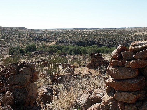
In conclusion, ||Khauxa!nas spanned the period from the resistance by the Orlam Afrikaners, aimed at retaining their group independence, to the more nationalistically-motivated anti-colonial struggle of the !Gami-#nun under Marengo's leadership a century later. By this time, a supra-tribal, unitary state was already in prospect. The connection between this move towards the idea of a national identity and the resistance symbol in the form of the old Nama fortress constitutes the real significance of the ancient settlement's rediscovery.

Standing on the southern (steeper) slope of
||Khauxa!nas, the Visitor looks across the Desolate Landscape which surrounds the
Fortified Settlement
Copyright of Photo: Dr. Klaus Dierks
Notes
[1] The samples of pottery remains and iron powder were given to me by J.A. Smith (died in Upington/South Africa in the mean time), the owner of the farm Back River 302 during February 1987. Mr. Smith recounted to me an old Nama story according to which this place was used as a meeting place for the Namib and Kalahari San who traded in diamonds (from the Namib) and gold (from the Kalahari). The owner of Gugunas 301 farm, H.J.K. Smith (died on 08.07.1996 in Kimberley/South Africa), told me about the rock paintings located on the overhanging cliff faces of the Bak River, just below the pathway leading to ||Khauxa!nas. These paintings were, however, destroyed during the massive flooding of the Bak River in 1972 when most of the trees along its banks were also swept away. It was not possible to trace any remains of these paintings during on the spot research at ||Khauxa!nas 1987-94. They were also not mentioned in: Scherz, Ernst R.: Felsbilder in Südwest-Afrika, Teil 3, Köln-Wien, 1986, p.389-390
[2] Dierks: ||Khauxa!nas, op cit, p.15 and Johannes du Bruyn: Oorlam Afrikaners: From Dependence to Dominance, ca 1760-1823, unpubl. paper, University of South Africa, Pretoria, 1981, p.1 as well as SWAPO: "Namibia: People's Resistance, 1670-1970", Race and Class, XXII, 1, 1980
[3] See last endnote and Smit, A. P.: Na Honderd Jaar: Eeufees: N.G. Gemeente Calvinia 1847-1947, Cape Town, 1946, p.16-20
[4] Vedder, Heinrich: Das Alte Südwestafrika, Windhoek, 1973, p.187
[5] Mossop, E.E. ed.: The Journals of Jacobus Coetse Jansz (1760) and Willem van Reenen (1791), Vol.15, Van Riebeeck Society, Cape Town, 1935, p.283
[6] Mossop, E.E. ed.: The Journals of Brink and Rhenius, being The Journal of Carel Frederik Brink of the Journey into Great Namaqualand (1761-1762), made by Captein Hendrik Hop, Vol.28, The Van Riebeeck Society, Cape Town, 1947, p.29-57
[7] Resolutions, A. van Schoor to Council of Policy, 4 September 1761, C 139, Cape Archives, p.417-420
[8] List of Persons banished to Robben Island 1758-1802, CJ 3189, Cape Archives
[9] Lau, Brigitte ed.: Carl Hugo Hahn, 1837-1860: Part V: Register and Indexes, Windhoek, 1985, p.1241
[10] Alexander, Neville: Responses to German Rule in Namibia or the Enigma of the Khowesin, Unpublished, 1982, p.12
[11] Ranger, T.: Connections between "Primary Resistance" Movements and Modern Mass Nationalism in East and Central Africa, Journal of African History IX (3&4), p.304
[12] Wesleyan Missionary Notices: Vol.5: 1828: Extracts from the Diary of the Deputy Landdrost, J. Ryneveld, Clanwilliam on 21 June 1827. See also next endnote.
[13] Dedering, T.: Southern Namibia, ca 1780 to 1840: The History of a Frontier Zone, Ph.-D.-Thesis, University of Cape Town, 1990, p.129-130; 132-135 (page numbers from draft-thesis)
[14] Mossop, E.E. ed.: The Journals of Brink and Rhenius, being The Journal of Carel Frederik Brink of the Journey into Great Namaqualand (1761-1762), made by Captein Hendrik Hop, Vol.28, The Van Riebeeck Society, Cape Town, 1947, p.94
[15] Mossop, E.E. ed.: The Journal of Hendrik Jacob Wikar (1779), Vol. 15, The Van Riebeeck Society, Cape Town, 1935, p.4 and 34 and Gordon, Robert Jacob: Cape Travels, 1777 to 1786, Vol.II, 30 September 1779, Houghton, 1988, p.301
[16] Campbell, John: Travels in South Africa, London, 1815, p.376
[17] Paterson, William: Into the Country of the Hottentots and Caffraria in the Years 1777, 1778 and 1779, State Library Pretoria, Microfiche Reprint Series No.2, 1789, p.60
[18] Gordon's letters and diaries: Gordon's Journal II: 27 Nov.1779, VC 593, Cape Archives
[19] Le Vaillant, Francois: Traveller in South Africa: Vernon S. Forbes: Le Vaillant's Travels in South Africa, 1781-1784, Cape Town, 1793, p.82
[20] Campbell, op cit, p.376
[21] Resolutions of Council of Policy, letter from Bletterman, 20 Nov. 1792, C 209, Cape Archives, p.245-251
[22] Quellen/Krönlein: Vol.24, Windhoek, 1864, p.100-102
[23] Mossop, E.E. ed.: The Journal of Willem van Reenen (1791), The Riebeeck Society, Cape Town, 1935, p.307
[24] Resolutions of the Council of Policy, Bletterman to Rhenius, 23 July 1793, C 217, Cape Archives, p.206-209
[25] Moritz E./Knudsen: Die ältesten Reiseberichte über Deutsch-Südwestafrika: Mitteilungen aus den deutschen Schutzgebieten, 1915, p.138
[26] Ridsdale, op cit, p.275
[27] Moffat: Missionary Labours and Scenes in South Africa, London, 1842, p.73-76
[28] Campbell, op cit, p.376 and Smit: Na Honderd Jaar, op cit, p.6-7 and 16. "Groot Toorn" still exists near present-day Calvinia
[29] Dedering, op cit, p.127-128
[30] Lau, Brigitte ed.: Carl Hugo Hahn, Part V, p.1241
[31] Ridsdale, op cit, p.275
[32] du Bruyn, op cit, p.10
[33] Moffat, op cit, p.77
[34] Van Wyk to van der Riet, 4 June 1799, BO 54, Cape Archives, p.49-52
[35] Borcherds: An Auto-Biographical Memoir, 1861, p.94-95
[36] LMS letter, Burgman, Cape Town, 10 Dec. 1811, CO, Vol. 2575, Landdr. van de Graaf to Earl of Caledon, Cape Archives
[37] Burchell: Travels in the Interior of Southern Africa, I, p.341 and Transaction of the Missionary Society, II, p.27-28
[38] The following records of the LMS were examined and not
a single reference to ||Khauxa!nas could be found:
A. Albrecht: Letters to the South African Society: 1807-1809: V1, volume 2/2
C. Albrecht: Letters to the South African Society: 1805-1809: V1, volume 2/2
LMS: Journals: A. and C. Albrecht: Journals to London Missionary Society, 1805-1814: on
microfilms: Cape Archives
A. and C. Albrecht: Letters to the London Missionary Society, 1806-1815, on microfilms,
Cape Archives
Johann Seidenfaden: Letters to South African Society: 1807-1810, V1, volume 2/3
[39] London Missionary Society: Directors' Report, 9 May 1816, London, p.27-28
[40] Moffat, op cit, p.85-89
[41] Oral information from T. Dedering
[42] Moffat, op cit, p.178-179
[43] Lau, Brigitte ed.: Carl Hugo Hahn, Part V, p.1242
[44] Green, Lawrence: Lords of the Last Frontier, Howard B Timmins, Cape Town, 1952, p.218
[45] Lau, Brigitte ed.: Carl Hugo Hahn, Part V, p.1297
[46] Budack, K.F.R.H.: Die traditionelle politische Struktur der Khoe-Khoen: Stamm und Stammesregierung auf historischer Grundlage, Ph.-D.-Thesis, University of Pretoria, 1972, p.249-251
[47] Lau, Brigitte ed.: Carl Hugo Hahn, Part V, p.1278
[48] Alexander, James Edward, op cit, p.208-214
[49] Mossop: Brink and Rhenius, p.41. Information with respect to the ruins on the farm Narudas 268 was supplied by Klaus Möller of Swakopmund and confirmed by the owners of Narudas, A.W.J. and B.F. Maritz and !Gami-#nun David Rooy. The latter local informants were adamant that the ruins were of German and not pre-colonial origin. Mr Maritz called one building "the Captain's house", meaning an officer of the German Schutztruppe, but it could also be a reference to ||Hawoben-chief Hendrik Henricks who lived here during the 1830s and 1840s most probably. "Narudas" means gliding down a skew wall (Toponymica Hottentotica, Volume B: THB) which could refer to the natural pegmatite ridges on Narudas hill to the north of the ruins.
[50] Ridsdale, op cit, p.163-169
[51] Dierks: ||Khauxa!nas, op cit, p.21
[52] Ridsdale, op cit, p.277-278
[53] Mears, W.G.A.: Wesleyan Missionaries in Great Namaqualand, 1820-1867, Cape Town, 1968, p.20-22
[54] Bailie, John A.: Diary 1845-1850: Copy of the written original: Cape Dutch Reformed Church Archives: P 50 1/1
[55] Mears, W.G.A., op cit, p.23
[56] Bailie, op cit
[57] Mears, op cit, p.25
[58] Budack, op cit, p.31-32, p.44 and p.251
[60] Records can be found in the Windhoek State Archives
[61] Clements, A.J.: The Kalahari and its Lost City, Cape Town, 1967
[62] Farini, G.A.: Through the Kalahari Desert: A Narrative of a Journey with Gun, Camera and Note-Book to Lake N'Gami and back, Reprint, Cape Town, 1973 and Goldie, Fay: Lost City of the Kalahari, Cape Town, 1963 which dealt with the Haldeman, Tainton-Hjalmar Reitz and Flower-Ibbetson expeditions in the 1950s and 1960s and Farini's book but which found no reference in the source material to ||Khauxa!nas. Information on this source provided by Randolph Vigne.
[63] De Kock, W.J.: Suid Afrikaanse Biografiese Woordeboek, Cape Town, 1968, p.492
[64] Rehbock, Th.: Deutsch-Südwest-Afrika, Berlin, 1898, p.17 and p.126-127
[65] Alexander, Neville: Jakob Marengo and Namibian History, Social Dynamics 7(1), Unpublished, Lecture Notes, Cape Town, 1981, p.1
[66] Davey, A.M.: The Bondelzwarts Affair of 1922, published in 1961
[67] Budack, op cit, p.23
[68] Lau, Brigitte ed.: Carl Hugo Hahn, Part V, p.1247
[69] Generalstab: Vol.2, op cit, p.282
[70] Witbooi, Hendrik: Die Dagboek van Hendrik Witbooi, Kaptein van die Witbooi-Hottentotte, 1884-1905, The Van Riebeeck Society, Cape Town, 1929, p.77
[71] Drechsler, op cit, p.71
[72] Generalstab: Vol.1, op cit, p.21-22 and Vol.2, p.6
[73] Otto, K.: Der Kriegszug gegen die Bondelzwarts: Ein verlorener Kriegszug, Kalkfontein, October 1904, p.28 and p.35. Marengo and Morris participated in the battle of Nauchenas (Amas 46) on 10.12.1903. See also Drechsler, Horst: Südwestafrika: p.175 and Schmiedel, H.: Hauptmann Friedrich von Erckert in Deutschsüdwestafrika und seine Zeit, Ansbach, 1974, p.182
[74] Drechsler, op cit, p.199
[75] Information by Willem Konjore, great grandson of a brother of Jakob Marengo, now Member of Parliament (National Assembly) of the independent Republic of Namibia
[76] Simon, John Marie: Bishop for the Hottentots: African Memories, 1882-1909, New York, 1959, p.186 and oral testimony by Willem Konjore, Koichas/Vaalgras, great-grandson of a brother of Jakob Marengo.
[77] Alexander, Neville: Marengo, op cit, p.5
[78] Drechsler, op cit, p.175-176
[79] Generalstab: Vol.2, op cit, p.6 and p.9 and letter Schmidt to Leutwein, dated 24.08.1904, Windhoek State Archives
[80] Letter: Keetmanshoop-records: Windhoek State Archives. First names of officials and soldiers were seldom used in official German records and "Generalstab" works.
[81] Von Dincklage-Campe, op cit, p.152-154. Another fortified camp which might have played a role as a secret refuge and was never discovered by the Germans could have been the one established by Marengo on farm Sandmodder 73, north of farm Geitsanes 75. See also Map: "Deutsch Südwest Afrika in Blättern", Map No. 25, Unfinished map: 1 : 400,000, Berlin, 1913. See also: Das Licht, 36. Jahrgang, Eichstätt/Germany, 1949, p.45 here Father Johann Malinowski mentioned Marengo's camp to be at the "Paviansschlucht" (Baboon's Gorge) which could not be identified. A "Pavianspforte" was according to the diaries of Captain Franke located 8 km east of the farm Garis in the direction of Stormlaagte, although the reference could also fit the Bak River area near ||Khauxa!nas where large number of baboons were to be found.
[82] Von einem Offizier der Schutztruppe: Meine Kriegserlebnisse in Deutsch-Süd-West-Afrika, Minden, 1907, p.148 and Generalstab: Vol.2, op cit, p.9
[83] Von Estorff, op cit, p.118, 132-134 and 136. See also Simon, op cit, p.185, 189, 192-193, 199 and Das Licht, op cit, p.30 and 45
[84] Drechsler, op cit, p.191 and Tuche, Paul: Als Veterinär im Lager des Feindes, Mitteilungsblatt des Traditionsverbandes für ehemalige Überseetruppen, 40/41, p.8. See also Generalstab: Vol.2, op cit, p.232 and Fischer, Adolf: Südwester Offiziere, Berlin, 1935, p.20-23 and von Dincklage-Campe, op cit, p.406-409
[85] Letter of Alfred Fryer to Governor of German S.W.A., dated 9 December 1910, Windhoek State Archives
[86] The dead soldiers were: Lieutenant Baron Nikolai von Stempel, Sergeant Heinrich Stolle, Corporal Otto Arndt and Trooper Ferdinand Schulz. They could only been buried on 11 September 1904 near the present-day farm house of Gugunas. See report: Schmidt to Leutwein, dated 19.09.1904, Windhoek State Archives
[87] Schmidt to Leutwein, dated 19.09.1904, Windhoek State Archives
[88] Letter of Alfred Fryer to Governor of German S.W.A., dated 9 December 1910, Windhoek State Archives
[89] See last endnote and report from Schmidt to Leutwein, dated 29.09.1904, and letter Major Kirchner to Fryer, dated 15.11.1904, Windhoek State Archives. The three older children were executed on Garabis. Two children, Wilhelm and Anna Fryer survived and lived later on the farm Back River 302. Information by J.A. Smith. According to Nienaber, G.S. and Raper, P.E.: Hottentot (Khoekhoen) Place Names, Durban/Pretoria, is "Garabis" now Plattbeen, Farm No.300, District Keetmanshoop. It is not sure whether the present name translates the old one, but this is probable. See also: Langhans' Deutscher Kolonial Atlas, Nr. 15, January 1894 where Garabis is situated on the present-day farm Plattbeen 300 near the place where main road 27 crosses the Bak River.
[90] Generalstab: Vol.2, op cit, p.11
[91] Alexander, Neville: Marengo, op cit, p.6
[92] Drechsler, op cit, p.183 and Schmiedel, H.: Hauptmann Friedrich von Erckert in Deutschsüdwestafrika und seine Zeit, Ansbach, 1974, p.171
[93] Henkel, Franz: Der Kampf um Südwestafrika, Berlin, 1908, p.39-42. See also Generalstab: Vol.2, op cit, p.68 and photograph on p.135
[94] Weck, Rüdiger: In Deutsch-Südwestafrika, 1913 bis 1915, Berlin, 1919, p.98-99 and Bäumler, Julius: Auf Patrouille in Südwest: 09.07 to 30.07.1910, private copy, p.8 and Schmiedel, op cit, p.189
[95] Generalstab: Vol.2, op cit, p.69-90
[96] Ibid, p.85-86. The evidence on Abraham Morris is based on oral evidence obtained by the author from Anna Veldskoen, 83 years of age, living near #Gabis, grand daughter of Abraham Morris.
[97] Ibid, p.134
[98] Ibid, p.136-137
[99] No records of Father Malinowski could be located in the Windhoek State Archives. According to Father Albert Rebmann of the Roman Catholic Mission in Rehoboth, formerly Gibeon, only letters by Malinowski survived and these were partially published in the periodical "Licht" of the Roman Catholic Congregation of the Oblates of St.Francis de Sales in Eichstätt/Germany. See "Das Licht: 36. Jahrgang", 1949. More information might be available in the archives of this congregation in Vienna or at Malinowski's home monastery in Chotieschau, Czechoslovakia, where he died on 7 February 1929. See also: Von Estorff, op cit, p.129-131
[100] Letter of A.J. Smit (Pretoria), 18 March 1987, p.1-7. Smit arrived on Schanzen as a four year-old boy in 1914 and was able to reconstruct many of the incidents around the "Skanse" based on the oral recollections of Klaas Dousab, whose father settled at ||Khauxa!nas in the 1850s, when the ||Hawoben still lived in the area. According to Smit, however, Dousab had no knowledge of anything earlier, for example, incidents relating to the presence of the Orlams at the turn of the 18th century. Prompted by Dousab's information, Smit was able to reconstruct the events of the Nama war in the Schanzen/Gugunas area during 1904-05. He remembered hearing that peace negotiations had taken place in the presence of a missionary (possibly Malinowski) on the "Skanse Berg". This was confirmed by further oral information supplied by J.A. Smith of the farm Back Rivier 302 during March 1988.
[101] Willem Johannes Louw was the younger brother of Johannes Louw. He was born on 11.12.1876 and died on 09.051949 and is buried on the Warmfontein farm. His brother Johannes Louw, the advisor of Jakob Marengo, was married to a Nama wife. He was born on 29.09.1868 and died on 05.05.1936 and is buried on the Warmfontein farm. Surely, the local white farmers regarded him as an outcast and traitor. This might be the reason that his tomb stone has been vandalised and lies for many decades next to this tomb. Both brothers are the sons of Cornelia Johanna Louw who was born on 28.10.1840 and died on 09.05.1909 and is buried next to her two sons on the Warmfontein farm.
[102] For the presence of a "European" advisor (Johannes Louw) to Marengo: See: Von einem Offizier der Schutztruppe: Meine Kriegserlebnisse in Deutsch-Süd-West-Afrika, Minden, 1907, p.148
[103] Unpublished report of an unidentified member of the Congregation of the Oblates of St.Francis de Sales: "Ein Beitrag zur Würdigung des Hottentottenaufstandes in Deutschsüdwestafrika von 1903-1906". See also: Das Licht, p.46 and 135: Smit's letter: p.4 where in both sources a German patrol of 6 soldiers is mentioned.
[104] Simon, op cit, p.190-191 and: Das Licht, 36.Jahrgang, 1949, p.61 where it is revealed how the German Rhenish missionary Fenchel from Keetmanshoop tried to sabotage Malinowski's peace efforts. See further Estorff, op cit, p.123 where von Estorff records that the German colonial authorities repeatedly violated his undertakings as commander to spare the lives of Nama resistance fighters and their families as well as to guarantee their liberty. A specific example was Samuel Isaak, second-in-command of the Witbooi-Nama, in December 1905. See also: Schmiedel, op cit, p.190-192
[105] Generalstab: Vol.2, op cit, p.139-141 and Schmiedel, op cit, p.193-194 as well as Anders: Friedrich v. Erckert, Berlin, 1910, p.245
[106] Schmiedel, op cit, p.195-204 and Budack, op cit, p.249-251
[107] Generalstab: Vol.2, op cit, p.347-348 and Drechsler, op cit, p.197-198 as well as a hand-drawn map in the Windhoek State Archives: "Skizze des Stationsbezirkes Dawignab: 15.03.1900"
[108] See last endnote: map and: "Das Licht: 36.Jahrgang", 1949, p.62
[109] See: Smit's letter: where also oral information from Klaas Louw, a farmer from the farm Devenishputs, in the vicinity of Schanzen/Gugunas, is recalled.
[110] Du Pisani, André: SWA/Namibia: The Politics of Continuity and Change, Jonathan Ball, Johannesburg, 1985, p.93
[111] Alexander, Neville: Marengo, op cit, p.8
[112] Windhoek High Court File: 43/1922: King versus Klaas Koper and Jan Hendrik charged with the "Crime of Attempted Murder".
|